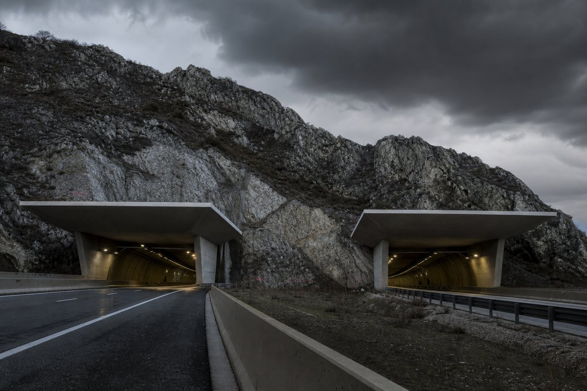
129 rows are rendered in total, so 44 of them carry a note or a blank where a length belongs and are shown without being counted. The middle half of the table runs from 0.1 km to 0.47 km, and that band is where most of the engineering on this page actually sits.
The 102 entries are grouped on the page under 20 headings — exit bari sardo sud (16), exit murtas (11), exit castiadas - solanas (9), exit quirra (8) and exit jerzu - lanusei - marina di gairo (8) — a classification the table carries as section breaks rather than as a column of its own.
The median entry measures 0.24 km, so half the table sits below that and half above, which is a better guide to the typical structure here than the headline figure. The shortest recorded entry is 0.06 km against 2.65 km at the top, a spread of 44.17x across the same table.
- 85entries listed
- 2.65 kmlongest bore
- 35.37 kmtotal length
The record table
How this archive measures: lengths, bores, dates and ordering
| Tunnel / Viaduct | Length | Notes |
|---|---|---|
| Reg. Sardinia – Prov. CA - Connection S.S.554 | ||
| Murtineddu | 2 591 m | |
| Is Stellas | 212 m | |
| Marapintau | 1 290 m | |
| Murtaucci | 354 m | |
| Is Canaleddus | 300 m | |
| Bruncu su Campu | 600 m | |
| Suergiu Mannu | 200 m | |
| Exit Geremeas | ||
| Geremeas | 540 m | |
| Baccu Peddis | 480 m | |
| Baccu Mandara | 400 m | |
| Arcu sa Ruxi | 120 m | |
| Arcu sa Ruxi | 320 m | |
| Arcu sa Porta | 2 650 m | |
| Exit Castiadas - Solanas | ||
| Svincolo | 165 m | |
| Costa Barbara | 81 m | |
| Cungiau Mannu | 417 m | |
| S'Arridellargiu | 140 m | |
| Rio Castangia | 361 m | |
| Rio Solanas | 725 m | |
| Gutturu Frascu | 2 628 m | |
| Rio Masone Murtas | 977 m | |
| Gutturu Frascu | 60 m | |
| Exit Villasimius - Castiadas | ||
| Rio Gutturu Frascu | 80 m | |
| Corr'e Pruna | 80 m | |
| Exit Olia Speciosa | ||
| Pispisa | 140 m | |
| Zingargiu | 28 m | |
| Rio Corr'e Pruna | 695 m | |
| Rio Picocca | 474 m | |
| Exit San Priamo | ||
| Ex SS 125 | 30 m | |
| Exit Burcei | ||
| Tremetzu | 65 m | |
| Arrexini | 1 921 m | |
| Cuilipaderi | 93 m | |
| Arrusadulu | 93 m | |
| Rio Mannu | 65 m | |
| Exit Muravera - Villaputzu | ||
| Sovrappasso SS387 | 40 m | |
| Exit San Vito - Ballao | ||
| Flumendosa | 1 415 m | |
| Sa Sperruma | 588 m | |
| Sa Ruinosa | 492 m | |
| Loi | 360 m | |
| Pitzu Agus | 475 m | |
| Exit Murtas | ||
| Murtas | 31 m | |
| Fraccis 2 | 126 m | |
| Fraccis | 240 m | |
| Marongiu | 285 m | |
| Barcone | 690 m | |
| Becciu | 240 m | |
| Pezzo | 265 m | |
| Pira Pisana | 35 m | |
| Sa Tramatzu | 290 m | |
| Farrù Intra | 295 m | |
| Craitta Intra | 275 m | |
| Exit Quirra | ||
| Quirra | 243 m | |
| Su Pirastu | 243 m | |
| Cucca | 130 m | |
| Mannu | 163 m | |
| Murgioni | 360 m | |
| Ponte Antas | 31 m | |
| Canna | 64 m | |
| San Giorgio | 64 m | |
| Exit San Giorgio | ||
| ------------------ | Section San Giorgio - Tertenia: in project | |
| Prov. CA - OG | ||
| Exit Tertenia Sud | ||
| Rio di Quirra | 210 m | |
| Rio Sibiri | 100 m | |
| Exit Tertenia | ||
| Rio Filixerru | 70 m | |
| Rio di Quirra | 140 m | |
| Exit Tertenia - Jerzu | ||
| Santu Perdu | 12 m | |
| Donnuigaglia | 18 m | |
| Su Crabriolu | 72 m | |
| Su Cabriolu | 72 m | |
| Exit Jerzu - Ulussai - Osini | ||
| Is Quaddazzonis | 1 390 m | |
| Is Funtaneddas | 200 m | |
| Viadotto | 12 m | |
| Rio Is Funtaneddas | 216 m | |
| Pranargia | 90 m | |
| Rio Pranargia | 72 m | |
| Is Carcuris I | 96 m | |
| Exit Jerzu - Lanusei - Marina di Gairo | ||
| Is Carcuris II | 48 m | |
| Is Carcuris III | 48 m | |
| Rio Serrasomu | 105 m | |
| Rio Donnixeddu | 30 m | |
| Cardedu (Pardo) | 621 m | Exit Cardedu on viaduct |
| Genna Ortiga | 1 692 m | |
| Gennalioni | 18 m | |
| Grisoni | 108 m | |
| Exit Bari Sardo Sud | ||
| Svincolo Bari Sardo | 30 m | |
| Viadotto | 321 m | |
| Viadotto | 144 m | |
| Susanna Fenu | 117 m | |
| Viadotto | 60 m | |
| Viadotto | 48 m | |
| Baccu Mula | 152 m | |
| Viadotto | 312 m | |
| Cuccureddu | 108 m | |
| Viadotto | 60 m | |
| Exit Bari Sardo Nord -Lanusei - Loceri; Viadotto (72 m) on ramp | ||
| Silimannu | 72 m | |
| Riu Mannu | 310 m | |
| Riu Bau de Giuanni | 510 m | |
| Accu Nieddu | 270 m | Temporary connection to S.S.125 |
| S'Abba sa Murta | 480 m | |
| Riu Baccu Arridela | 360 m | |
| Exit Cea | ||
| Section Cea - Tortolì: under construction | ||
| Exit Tortolì - Lido di Orrì | ||
| Fuddeddu | 125 m | |
| Exit Tortolì - Arbatax Porto - Lanusei | ||
| Viadotto | 30 m | |
| Ferrovie Sarde | 90 m | |
| Exit Arbatax Porto - Z.I. | ||
| Exit Girasole | ||
| Connection old S.S.125 |
How this table is compiled
The three longest entries alone account for 7.87 km of the 35.37 km on this page, which is 22 per cent of the total from 3 of 85 rows. The shorter half of the table totals 4.86 km against 30.51 km for the longer half, from the same number of rows.
The longest stands 0.02 km clear of the next longest, which is the margin to watch when a new scheme is announced. The captions name 13 distinct places and structures — Lanusei, Prov and Connection among them — and those names are the index into the length tables where each is recorded with its own figure.
Between the longest and the tenth-longest the drop is 1.93 km, which is the part of the table that changes when a single scheme opens. Where one of these 85 lengths disagrees with an operator's own figure for Italy, the table keeps the published value and notes the difference instead of averaging the two.
Lengths for Italy are recorded in metres which is how the operators publish them and why the shortest entry here reads as 60 m and not a rounded figure. The longest entry is 44.2 times the shortest and 11.0 times the median, which is the quickest measure of how uneven the table is.
A new scheme in Italy would have to beat 2.65 km to change the head of this table, and that is the figure worth rechecking when one opens. The eighth longest is Marapintau at 1.29 km, which is about where this record stops being about record holders and starts being about ordinary infrastructure.
Reading the figures
The tunnel / viaduct column names 92 distinct entries on this page, Murtineddu and Is Stellas among them, each traceable to the operator or administration record it was taken from. Swelling clays take up water and press on the invert for years after a tunnel opens, so some linings are designed to yield rather than resist.
Read down the length column, the 101 values run from 12 m to 2 650 m with a midpoint at 163 m; the spread rather than the maximum is what says how uneven this set is. A base tunnel trades a much greater length for a far lower summit altitude and a gentler ruling gradient.
The next two longest are Gutturu Frascu at 2.63 km and Murtineddu at 2.59 km. The material on this page is held in 5 captions rather than in running text, 37 words of it, each written against the image or row it belongs to by the compiler who put the page together.
Also recorded here are Genna Ortiga at 1.69 km and Flumendosa at 1.42 km. A tunnel list for Italy reads differently from a neighbouring country's: 0 of these 85 structures pass three kilometres, and the same journey time is bought with one long bore in one country and a dozen short ones in another.
77 entries fall below a kilometre, short enough that portals and approaches usually decided their cost more than the bore itself. Laid end to end the entries on this page would run 35.37 km, which is a number with no engineering meaning but a useful sense of the scale of what is catalogued.
Questions about Italy
What is the longest structure in Italy?
On the figures recorded here it is Arcu sa Porta, at 2.65 km. It is the longest of the 85 entries recorded here, measured by bore length rather than span, cost or construction difficulty.
How many structures are listed for Italy?
85 entries with a recorded length appear on this page, from 0.06 km at the short end to 2.65 km at the top, with the middle of the set around 0.24 km. The table renders 129 rows in total; the rest carry a note or a blank where a length belongs.
What is a typical length among the structures listed for Italy?
The median entry measures 0.24 km and the middle half of the table runs from 0.1 km to 0.47 km. The headline figure of 2.65 km is the outlier, not the norm, which is why the median is the more useful number when comparing one national list against another.
How close is the top of the Italy table?
The longest stands 0.02 km clear of the next entry, and 3 entries sit within ten per cent of it. A newly announced scheme therefore has to beat 2.65 km to displace Arcu sa Porta.
Other pages in this section
- Structures on the A1 var: the Variante di Valico, Bologna to Firenze
- Tunnels and Viaducts on the A01 Motorway in Italy, by Kilometre Point
- Tunnels and Viaducts on the A02 Motorway in Italy, by Kilometre Point
- Tunnels and Viaducts on the A03 Motorway in Italy, by Kilometre Point
- Tunnels and Viaducts on the A04 Motorway in Italy, by Kilometre Point
- Tunnels and Viaducts on the A05 Motorway in Italy, by Kilometre Point
- Tunnels and Viaducts on the A06 Motorway in Italy, by Kilometre Point
- Tunnels and Viaducts on the A07 Motorway in Italy, by Kilometre Point
- Tunnels and Viaducts on the A08 Motorway in Italy, by Kilometre Point
- Tunnels and Viaducts on the A09 Motorway in Italy, by Kilometre Point
- Tunnels and Viaducts on the A10 Motorway in Italy, by Kilometre Point
- Tunnels and Viaducts on the A11 Motorway in Italy, by Kilometre Point
- Tunnels and Viaducts on the A12 Motorway in Italy, by Kilometre Point
- Tunnels and Viaducts on the A13 Motorway in Italy, by Kilometre Point
- Tunnels and Viaducts on the A14 Motorway in Italy, by Kilometre Point
- Tunnels and Viaducts on the A15 Motorway in Italy, by Kilometre Point
- Tunnels and Viaducts on the A16 Motorway in Italy, by Kilometre Point
- Tunnels and Viaducts on the A18 Motorway in Italy, by Kilometre Point
- Tunnels and Viaducts on the A19 Motorway in Italy, by Kilometre Point
- Tunnels and Viaducts on the A20 Motorway in Italy, by Kilometre Point
- Tunnels and Viaducts on the A21 Motorway in Italy, by Kilometre Point
- Tunnels and Viaducts on the A22 Motorway in Italy, by Kilometre Point
- Tunnels and Viaducts on the A23 Motorway in Italy, by Kilometre Point
- Tunnels and Viaducts on the A24 Motorway in Italy, by Kilometre Point
- Tunnels and Viaducts on the A25 Motorway in Italy, by Kilometre Point
- Tunnels and Viaducts on the A26 Motorway in Italy, by Kilometre Point
- Tunnels and Viaducts on the A27 Motorway in Italy, by Kilometre Point
- Tunnels and Viaducts on the A28 Motorway in Italy, by Kilometre Point
- Tunnels and Viaducts on the A29 Motorway in Italy, by Kilometre Point
- Tunnels and Viaducts on the A30 Motorway in Italy, by Kilometre Point
- Tunnels and Viaducts on the A31 Motorway in Italy, by Kilometre Point
- Tunnels and Viaducts on the A32 Motorway in Italy, by Kilometre Point
- Tunnels and Viaducts on the A33 Motorway in Italy, by Kilometre Point
- Tunnels and Viaducts on the A34 Motorway in Italy, by Kilometre Point
- Tunnels and Viaducts on the A35 Motorway in Italy, by Kilometre Point
- Tunnels and Viaducts on the A36 Motorway in Italy, by Kilometre Point
- Tunnels and Viaducts on the A4-A31-A27 Motorway, by Kilometre Point
- Tunnels and Viaducts on the A50 Motorway in Italy, by Kilometre Point
- Tunnels and Viaducts on the A51 Motorway in Italy, by Kilometre Point
- Tunnels and Viaducts on the A52 Motorway in Italy, by Kilometre Point
- Tunnels and Viaducts on the A58 Motorway in Italy, by Kilometre Point
- Tunnels and Viaducts on the A90 Motorway in Italy, by Kilometre Point
- Tunnels and Viaducts on the D08 Motorway in Italy, by Kilometre Point
- Tunnels and Viaducts on the D11 Motorway in Italy, by Kilometre Point
- Tunnels and Viaducts on the D15 Motorway in Italy, by Kilometre Point
- Tunnels and Viaducts on the D29 Motorway in Italy, by Kilometre Point
- Tunnels and Viaducts on the D29A Motorway in Italy, by Kilometre Point
- Traforo del Monte Bianco: the Mont Blanc Tunnel Reopened in 2002
- Tunnels and Viaducts on the R03 Motorway in Italy, by Kilometre Point
- Tunnels and Viaducts on the R04 Motorway in Italy, by Kilometre Point
- Tunnels and Viaducts on the R30 Motorway in Italy, by Kilometre Point
- Tunnels and Viaducts on the R33 Motorway in Italy, by Kilometre Point
- Tunnels on the Italian State Roads SS 100 to SS 199, Listed by Route
- Tunnels and Viaducts on the SS33 Motorway in Italy, by Kilometre Point
- Tunnels and Viaducts on the SS340 in Italy, by Kilometre Point
- Tunnels and Viaducts on the SS36 Motorway in Italy, by Kilometre Point
- Tunnels and Viaducts on the SS38 Motorway in Italy, by Kilometre Point
- Tunnels and Viaducts on the TEM — Tangenziale Esterna Est Milano
- Motorways' Chronology in Italy — Section Openings Listed by Date
- Motorways in Italy, Page 2 — Tunnels and Viaducts by Kilometre Point
- Motorways in Italy — the Numbering Scheme, Routes and Structures
- The Furlo Tunnel in Italy: Portals, Photographs and Setting
- Road Tunnels in Italy — Complete List by Length, Part 1000
- Road Tunnels in Italy — Complete List by Length, Part 750
- Road Tunnels in Italy — Complete List by Length
Cite this page
Tunnels and Viaducts on the S.S. 125 var, Cagliari to Tortoli. The World's Longest Tunnels. https://www.lotsberg.net/data/italia/SS125_var.html
Related record tables
- BART Tunnels and Tubes in the San Francisco Bay Area
- The Salang Tunnel in Afghanistan: Road and Galleries
- The Perisher Blue Skitube: a Rack Railway in Australia
- Tunnels and Viaducts on the A8 Motorway in France
- Tunnels and Viaducts on the A43 Motorway in France
- Structures on the A51 Motorway in France
- Der Alte Elbtunnel: the Old Elbe Tunnel in Hamburg
- Structures on the A1 var, Variante di Valico, Italy
- Tunnels and Viaducts on the A01 Motorway in Italy
- Tunnels and Viaducts on the A02 Motorway in Italy
- Tunnels and Viaducts on the A03 Motorway in Italy
- Tunnels and Viaducts on the A04 Motorway in Italy