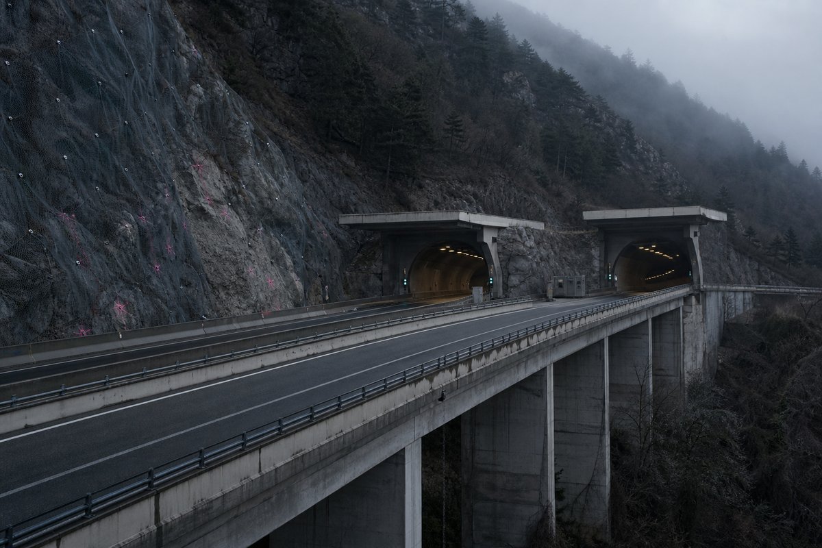
315 rows are rendered in total, so 37 of them carry a note or a blank where a length belongs and are shown without being counted. The middle half of the table runs from 0.16 km to 0.42 km, and that band is where most of the engineering on this page actually sits.
The median entry measures 0.27 km, so half the table sits below that and half above, which is a better guide to the typical structure here than the headline figure. The shortest recorded entry is 0.04 km against 1.85 km at the top, a spread of 51.44x across the same table.
The three longest entries alone account for 5.37 km of the 96.51 km on this page, which is 6 per cent of the total from 3 of 278 rows. 139 entries sit above the median and 139 at or below it, so the table is evenly weighted and not clustered at one end.
- 278entries listed
- 1.85 kmlongest bore
- 96.51 kmtotal length
The record table
How this archive measures: lengths, bores, dates and ordering
| Tunnel / Viaduct | Direction France | Direction Genova | Notes | km |
|---|---|---|---|---|
| Connection A7 – Milano / Region Liguria – prov. GE | 0+000 | |||
| Polcevera | 1 102 m | 1 102 m | ||
| Coronata | 942 m | 944 m | 2+120 | |
| Exit Genova Aeroporto. Tunnels Coronata (53 m, dir. France) and Sant'Andrea (107 m, dir. Genova) on ramps | 2+300 | |||
| Don Guanella | 520 m | 521 m | 2+845 | |
| Ruscarolo | 380 m | 380 m | ||
| Chiaravagna | 160 m | 160 m | ||
| Sestri | 435 m | 405 m | 4+120 | |
| Cantarena | 250 m | 253 m | 4+725 | |
| Molinassi | 118 m | 118 m | ||
| Rollino | 164 m | - | ||
| Marotta | 36 m | 36 m | 5+628 | |
| Chiesa | 340 m | 338 m | 5+719 | |
| Exit Genova Pegli | 6+060 | |||
| Varenna | 420 m | 420 m | ||
| Pallavicini | 713 m | 478 m | 6+610 | |
| Lupo | - | 156 m | 7+129 | |
| Rexello | - | 127 m | No road signal | 7+382 |
| Provenzale | 958 m | - | ||
| San Paolo della Croce | 755 m | 7+559 | ||
| San Pietro | 265 m | - | ||
| Pegli | - | 306 m | 8+432 | |
| San Pietro | 100 m | 318 m | ||
| Torrazza | 165 m | - | ||
| Pra | 619 m | |||
| Branega | 178 m | 132 m | ||
| Voltri | - | 200 m | 10+275 | |
| Palmaro | 251 m | |||
| Exit Genova Voltri | 10+700 | |||
| Voltri | 86 m | |||
| Chiappa | 156 m | 197 m | ||
| Leira | 294 m | - | ||
| Madonna delle Grazie I | 386 m | - | ||
| Cerusa Q | 250 m | |||
| Connection A 26 - Gravellona Toce | 12+600 | |||
| Mervalo | 336 m | - | ||
| Artif. Terrazzo | - | 12 m | 13+007 | |
| Ponte ad Archi | - | 98 m | ||
| Fontanelle | 118 m | 87 m | ||
| Cerusa | 350 m | 200 m | ||
| Crevari | 716 m | 436 m | 13+535 | |
| Uccelliera | - | 178 m | ||
| Borgonuovo | 722 m | - | ||
| Vesima | 230 m | 192 m | ||
| Beo | 90 m | - | ||
| Frana | - | 104 m | ||
| Lupara | 232 m | 225 m | ||
| Egua | - | 128 m | ||
| Lupara | 321 m | - | ||
| Terrarossa II | 121 m | - | ||
| Terrarossa III | 179 m | 179 m | 18+026 | |
| Bicocca II | - | 41 m | ||
| Bicocca III | - | 41 m | ||
| Cantarena | 190 m | 194 m | ||
| Mina | 41 m | |||
| Arenzano | 238 m | - | ||
| Della Rovere | 42 m | - | ||
| Castello II | - | 58 m | 18+751 | |
| Castello III | - | 134 m | 18+829 | |
| Castello | 80 m | 80 m | ||
| Art. Migliarini | 100 m | 87 m | ||
| Exit Arenzano | 20+200 | |||
| Terralba | 240 m | - | ||
| Colletta | 202 m | 20+753 | ||
| Lerone | 310 m | 235 m | ||
| Lerone | - | 357 m | 21+325 | |
| Maxetti | 624 m | - | ||
| Lepri | 208 m | - | ||
| Terroso | 155 m | 75 m | ||
| Cogoleto 1 | 79 m | 160 m | 22+294 | |
| Celano | 116 m | 140 m | ||
| Cogoleto 2 | 361 m | - | ||
| Rumaro | 60 m | - | ||
| Beuca | 641 m | - | ||
| Arrestra | - | 89 m | 23+926 | |
| Arrestra | 285 m | 143 m | Prov. GE - SV | |
| San Giacomo | 264 m | - | Prov. SV | |
| Arenon II | 199 m | - | ||
| Arenon III | 180 m | - | ||
| Vignetta | 734 m | - | ||
| Cavetto 1 | 241 m | - | ||
| Cavetto 2 | 295 m | - | ||
| Varazze | 374 m | - | ||
| Teiro | 246 m | - | ||
| Cantalupo | 768 m | - | ||
| Portigliolo | - | 186 m | ||
| Q8 | / | Service Areas "Piani d'Invrea Nord" | ||
| / | Total | Service Areas "Piani d'Invrea Sud" | 26+000 | |
| Exit Varazze | 26+800 | |||
| Mola | - | 201 m | ||
| Arzocco | - | 170 m | ||
| ? | 330 m | |||
| Don Bosco | - | 442 m | 30+181 | |
| Castagna Buona | 76 m | - | ||
| Castagna Buona | 49 m | - | ||
| Boschetto | - | 71 m | 30+397 | |
| Rianello | - | 135 m | ||
| Cucco | 159 m | 134 m | ||
| Piani di Celle | 363 m | - | ||
| Exit Celle Ligure. Tunnel Natta (430 m) on ramp | 31+700 | |||
| Liggie | 126 m | 144 m | ||
| Costa | 144 m | |||
| Costa | 336 m | 79 m | 32+580 | |
| Lavatore Sanda | 313 m | 342 m | ||
| Boschi | 198 m | - | 33+250 | |
| Casanova | - | 86 m | 33+093 | |
| Santa Brigida | 126 m | - | ||
| Casanova | - | 147 m | ||
| Cassisi | 505 m | 182 m | 33+430 | |
| Terrizza | - | 196 m | 33+765 | |
| Rio Lorio | 114 m | 147 m | ||
| Arma | 127 m | |||
| Arma | 91 m | 100 m | 34+237 | |
| Pecorile | 662 m | 191 m | 34+653 | |
| Siri | 500 m | - | 35+388 | |
| Fighetto | - | 137 m | 34+983 | |
| Rossello M.G. | - | 476 m | ||
| Exit Albisola | 36+400 | |||
| Rio Basco | 66 m | 66 m | ||
| Sansobbia | 70 m | 70 m | ||
| Torre Faraggiana | 252 m | 277 m | 37+279 | |
| Monte Pasasco | 664 m | 658 m | 38+100 | |
| Termine | 308 m | 225 m | 38+277 | |
| Ranco | 272 m | 260 m | 38+990 | |
| Art.San Giuseppe | 50 m | One tube, both carriageways | 39+320 | |
| Letimbro | 325 m | 325 m | ||
| Letimbro | 241 m | 241 m | 40+617 | |
| Rio Cadeina | 130 m | 130 m | ||
| Art. Mongrifone | 75 m | One tube, both carriageways | 41+067 | |
| Galletto | 129 m | 129 m | ||
| Tamoil | Tamoil | Service Areas "San Cristoforo" | 42+300 | |
| Bricco Molinero | 254 m | 254 m | ||
| Bricco | 104 m | 104 m | 43+021 | |
| Quattro stagioni | 96 m | 96 m | 43+392 | |
| Smarre | 92 m | 92 m | ||
| Connection A6 Torino - Exit Savona. Service Area "Aurelia Sud" (Total) on ramp | 44+721 | |||
| Quiliano | 89 m | 89 m | ||
| Campo Sportivo | 307 m | 307 m | ||
| Esso | / | Service Area "Valleggia Nord" | 46+100 | |
| Celesia | 242 m | 242 m | ||
| Segno | 319 m | 319 m | ||
| Fornaci | 1 658 m | 1 669 m | ADAC test | |
| Crovetto | 364 m | 364 m | ||
| Exit Spotorno | 52+705 | |||
| Tosse | 205 m | 255 m | ||
| Cardavia | 151 m | 150 m | ||
| Bassadonna | 205 m | 252 m | ||
| Coreallo | 124 m | 97 m | ||
| Santa Libera | 491 m | 521 m | ||
| / | Api | Service Area "Borsana Sud" | 55+702 | |
| Borsana | 90 m | 148 m | ||
| Barelli | 614 m | 540 m | ||
| Orco | 1 062 m | 1 089 m | ||
| Aquila | 429 m | 429 m | ||
| Exit Orco – Feglino | 59+396 | |||
| Rocca Carpanea | 1 828 m | 1 844 m | ||
| Porra | 665 m | 665 m | Exit Finale Ligure | 62+982 |
| Bracciale | 939 m | 907 m | ||
| Bottassano | 159 m | 190 m | ||
| Monte Grosso | 1 344 m | 1 366 m | ||
| Maremola | 336 m | 320 m | ||
| Giustenice | 349 m | 349 m | ||
| Exit Pietra Ligure | 67+666 | |||
| Ranzi | 221 m | 235 m | ||
| Bric 5 alberi | 379 m | 379 m | ||
| Seminario | 214 m | 214 m | ||
| Nimbalto | 131 m | 131 m | ||
| Meceti | 308 m | 300 m | ||
| Boissano | 237 m | 237 m | ||
| Castellaro | 281 m | 275 m | ||
| Exit Borghetto Santo Spirito | ||||
| Varatella | 149 m | 149 m | ||
| Armussi | 111 m | 95 m | ||
| Monte Piccaro | 769 m | 783 m | ||
| Ceriale | 240 m | 240 m | ||
| Torsero | 102 m | 102 m | ||
| Esso-IP | Agip | Service Areas "Ceriale" | 77+478 | |
| Exit Albenga | 81+211 | |||
| Neva | 244 m | 246 m | ||
| Bastia III | 91 m | 91 m | ||
| Bastia II | 132 m | 132 m | ||
| Arroscia | 270 m | 270 m | ||
| Isoleri | - | 278 m | ||
| Caso | 241 m | 241 m | ||
| Furioso | 159 m | 159 m | ||
| Vallon d’Arme | 1 594 m | 1 609 m | ||
| Bric Arpicella | 423 m | 439 m | ||
| San Bernardo | 490 m | 490 m | ||
| Rio di Negri | 367 m | 367 m | ||
| Molino Nuovo III | 183 m | 183 m | ||
| Molino Nuovo II | 161 m | 161 m | ||
| Marino | 172 m | 198 m | ||
| Exit Andora | 93+230 | |||
| Merula | 855 m | 855 m | ||
| Tamoil | / | Service Area "Rinovo Nord" | 95+066 | |
| Rinovo | 358 m | 363 m | ||
| Colle Dico | 1 635 m | 1 633 m | Prov. SV – IM | |
| / | Esso | Service Area "Valle Chiappa Sud" | 97+706 | |
| Chiappa | 158 m | 136 m | Prov. IM | |
| Cervo | 541 m | 541 m | ||
| San Bartolomeo | 361 m | 361 m | ||
| Exit San Bartolomeo a Mare | 99+972 | |||
| Vallovaira | 202 m | 202 m | ||
| Pineta | 263 m | 263 m | ||
| Santa Lucia | 410 m | 415 m | ||
| San Pietro | 274 m | 284 m | ||
| Diano Castello | 388 m | 391 m | ||
| Varcavello | 269 m | 269 m | ||
| Diano Calderina | 251 m | 251 m | ||
| Gorleri | 273 m | 267 m | ||
| Gorleri | 1 012 m | 1 027 m | ||
| San Luca | 357 m | 332 m | ||
| Oliveto III | 164 m | 164 m | Exit Imperia Est | 106+297 |
| Oliveto II | 219 m | 268 m | ||
| Oliveto | 211 m | 227 m | ||
| Castelvecchio | 195 m | 245 m | ||
| Impero | 572 m | 515 m | ||
| S.Agata | 112 m | 89 m | ||
| Costa Ravotto | 217 m | 128 m | ||
| Costa Ravotto | 121 m | 119 m | ||
| Bardellina | 175 m | 175 m | ||
| Delle Valli | 182 m | 182 m | ||
| San Leonardo | 282 m | 282 m | ||
| Artallo | 282 m | 282 m | ||
| Sant’Antonio | 294 m | 292 m | ||
| Caramagna | 543 m | 543 m | ||
| Exit Imperia Ovest | 112+235 | |||
| Prino | 856 m | 856 m | ||
| Poggi | 529 m | 550 m | ||
| Barbarossa | 514 m | 516 m | ||
| Poitexelli | 515 m | 515 m | ||
| Terre Bianche | 394 m | 394 m | ||
| San Lorenzo | 809 m | 809 m | ||
| Costarainera | 449 m | 323 m | ||
| Costarainera | 330 m | 359 m | ||
| Cipressa | 286 m | 242 m | ||
| Aregai | 181 m | 181 m | ||
| Madonna della Corte | 180 m | 180 m | ||
| Rio Guandi | 228 m | 228 m | ||
| Caravella | 146 m | 146 m | ||
| / | Tamoil | Service Area "Conioli Sud" | 120+313 | |
| Conioli | 226 m | 226 m | ||
| Terzorio | 400 m | 394 m | ||
| Valle Tufo | 244 m | 267 m | ||
| Pompeiana | 806 m | 787 m | ||
| Lagoscuro | 285 m | 285 m | ||
| Total | / | Service Area "Castellaro Nord" | 123+114 | |
| Caravello | 279 m | 260 m | ||
| San Michele | 335 m | 366 m | ||
| Castellaro | 148 m | 148 m | ||
| Taggia | 662 m | 662 m | ||
| Valle Ferraie | 201 m | 201 m | ||
| Giamanassa | 502 m | 488 m | ||
| Santa Lucia | 161 m | 161 m | ||
| Fasce Lunghe | 219 m | 211 m | ||
| Rio Baltexe | 273 m | 273 m | ||
| Dei Colli | 161 m | 161 m | ||
| Exit Arma di Taggia – San Remo Est | 128+412 | |||
| Rio Perriane | 162 m | 162 m | ||
| Costa Amoretti | 557 m | 557 m | ||
| Rio Cascine | 282 m | 282 m | ||
| Armea | 609 m | 609 m | ||
| Poggio | 429 m | 437 m | ||
| Val d’Ulivi | 161 m | 202 m | ||
| San Martino | 407 m | 398 m | ||
| San Martino | 496 m | 496 m | ||
| Curbinei | 44 m | 44 m | ||
| N.S. Villetta | 558 m | 504 m | ||
| Rio del Ponte | 372 m | 388 m | ||
| Montà di Lanza | 250 m | 254 m | ||
| Tasciaire | 179 m | 179 m | ||
| Costa dei Farina | 411 m | 411 m | ||
| San Francesco | 360 m | 360 m | ||
| Suseneo | 177 m | 131 m | ||
| Cardellina | 323 m | 311 m | ||
| San Romolo | 511 m | 490 m | ||
| San Bartolomeo III | 380 m | 399 m | ||
| Rio Gozzo | 371 m | 385 m | ||
| Rio Foce | 280 m | 280 m | ||
| San Lorenzo | 430 m | 427 m | ||
| Exit Sanremo | 139+370 | |||
| Coldirodi | 174 m | 174 m | ||
| Fosso Bianco | 405 m | 445 m | ||
| Costa Martina | 289 m | 278 m | ||
| T. dei Pini | 241 m | 242 m | ||
| Rio Pelotta | 121 m | 161 m | ||
| Rio Colmo | 223 m | 223 m | ||
| Agip | Agip | Service Areas "Bordighera" | 143+544 | |
| Madonna della Ruota | 87 m | 87 m | ||
| Madonna della Ruota | 627 m | 391 m | ||
| Bordighera | 340 m | 340 m | ||
| Sasso | 513 m | 513 m | ||
| Exit Bordighera | 145+797 | |||
| Borghetto | 675 m | 675 m | ||
| Monte Bauso | 465 m | 465 m | ||
| Valle Crosia | 499 m | 506 m | ||
| Colle Aprosio | 848 m | 851 m | ||
| Nervia | 881 m | 865 m | ||
| Freida | - | |||
| Siestro | 1 852 m | 1 852 m | ||
| Roja | 362 m | 362 m | ||
| Exit Ventimiglia. Service Area "Autoporto" (Agip) on ramp | 151+849 | |||
| Toll Barrier Ventimiglia- ex custom | ||||
| Del Monte | 1 656 m | 1 543 m | ||
| San Bartolomeo II | 292 m | 315 m | ||
| Valle Latte | 678 m | 600 m | ||
| Belvedere | 344 m | 334 m | 155+237 | |
| Belvedere | 88 m | 88 m | 155+592 | |
| Mortola | 155 m | 124 m | 155+935 | |
| Mortola | 369 m | 86 m | 156+071 | |
| Val Sorba | 15 m | 45 m | 156+496 | |
| Grimaldi | 761 m | 790 m | 156+963 | |
| Del Passo | 191 m | 191 m | 157+747 | |
| Cima Girata/ Giraude | 415 m(I:162) | 455 m(I:150) | French border | 158+120 |
| TOTAL tunnels | 50 227 m | 43 552 m |
How this table is compiled
The route table lists 278 structures with a recorded length, giving both carriageways where the two bores differ. The table on this page runs to 313 rows and records Tunnel / Viaduct, Direction France, Direction Genova, Notes and km for each of them, which is the shape the original compiler chose rather than one imposed here.
268 entries fall below a kilometre, short enough that portals and approaches usually decided their cost more than the bore itself. Read down the direction france column, the 247 values run from 15 to 50 227 with a midpoint at 273; the spread rather than the maximum is what says how uneven this set is.
Between the longest and the tenth-longest the drop is 0.83 km, which is the part of the table that changes when a single scheme opens. Where one of these 278 lengths disagrees with an operator's own figure for Italy, the table keeps the published value and notes the difference instead of averaging the two.
This page records the structures catalogued along the A10 in Italy, in a tunnel almanac maintained at this address since the late 1990s. The captions name 23 distinct places and structures — Area, Milano and Region among them — and those names are the index into the length tables where each is recorded with its own figure.
Lengths for Italy are recorded in metres which is how the operators publish them and why the shortest entry here reads as 36 m and not a rounded figure. The longest entry is 51.4 times the shortest and 7.0 times the median, which is the quickest measure of how uneven the table is.
Reading the figures
A new scheme in Italy would have to beat 1.85 km to change the head of this table, and that is the figure worth rechecking when one opens. The eighth longest is Polcevera at 1.1 km, which is about where this record stops being about record holders and starts being about ordinary infrastructure.
The shorter half of the table totals 22.18 km against 74.33 km for the longer half, from the same number of rows. Only 80 of the 313 rows carry anything in the km column, so that field describes a minority of this table and the rest of the rows are recorded without it.
On 113 of the structures here the two carriageways are not the same length, which is why the archive records each direction separately rather than one figure per crossing. The note column records 22 exits, 3 motorway connections, 1 toll barriers and 8 service areas along the route, in running order rather than by size.
The material on this page is held in 6 captions rather than in running text, 60 words of it, each written against the image or row it belongs to by the compiler who put the page together. The kilometre point is recorded for each structure on the A10, which is how the operator identifies it.
The longest stands 0.01 km clear of the next longest, which is the margin to watch when a new scheme is announced. Laid end to end the entries on this page would run 96.51 km, which is a number with no engineering meaning but a useful sense of the scale of what is catalogued.
Questions about Italy
What is the longest structure in Italy?
On the figures recorded here it is Siestro, at 1.85 km. It is the longest of the 278 entries recorded here, measured by bore length rather than span, cost or construction difficulty.
How many structures are listed for Italy?
278 entries with a recorded length appear on this page, from 0.04 km at the short end to 1.85 km at the top, with the middle of the set around 0.27 km. The table renders 315 rows in total; the rest carry a note or a blank where a length belongs.
What is a typical length among the structures listed for Italy?
The median entry measures 0.27 km and the middle half of the table runs from 0.16 km to 0.42 km. The headline figure of 1.85 km is the outlier, not the norm, which is why the median is the more useful number when comparing one national list against another.
How close is the top of the Italy table?
The longest stands 0.01 km clear of the next entry, and 3 entries sit within ten per cent of it. A newly announced scheme therefore has to beat 1.85 km to displace Siestro.
How many structures does this route carry?
278 named tunnels and viaducts have a recorded length on this route, the longest being Siestro at 1.85 km, followed by Rocca Carpanea at 1.84 km and Fornaci at 1.67 km; 223 of the 278 are under 500 metres.
Other pages in this section
- Structures on the A1 var: the Variante di Valico, Bologna to Firenze
- Tunnels and Viaducts on the A01 Motorway in Italy, by Kilometre Point
- Tunnels and Viaducts on the A02 Motorway in Italy, by Kilometre Point
- Tunnels and Viaducts on the A03 Motorway in Italy, by Kilometre Point
- Tunnels and Viaducts on the A04 Motorway in Italy, by Kilometre Point
- Tunnels and Viaducts on the A05 Motorway in Italy, by Kilometre Point
- Tunnels and Viaducts on the A06 Motorway in Italy, by Kilometre Point
- Tunnels and Viaducts on the A07 Motorway in Italy, by Kilometre Point
- Tunnels and Viaducts on the A08 Motorway in Italy, by Kilometre Point
- Tunnels and Viaducts on the A09 Motorway in Italy, by Kilometre Point
- Tunnels and Viaducts on the A11 Motorway in Italy, by Kilometre Point
- Tunnels and Viaducts on the A12 Motorway in Italy, by Kilometre Point
- Tunnels and Viaducts on the A13 Motorway in Italy, by Kilometre Point
- Tunnels and Viaducts on the A14 Motorway in Italy, by Kilometre Point
- Tunnels and Viaducts on the A15 Motorway in Italy, by Kilometre Point
- Tunnels and Viaducts on the A16 Motorway in Italy, by Kilometre Point
- Tunnels and Viaducts on the A18 Motorway in Italy, by Kilometre Point
- Tunnels and Viaducts on the A19 Motorway in Italy, by Kilometre Point
- Tunnels and Viaducts on the A20 Motorway in Italy, by Kilometre Point
- Tunnels and Viaducts on the A21 Motorway in Italy, by Kilometre Point
- Tunnels and Viaducts on the A22 Motorway in Italy, by Kilometre Point
- Tunnels and Viaducts on the A23 Motorway in Italy, by Kilometre Point
- Tunnels and Viaducts on the A24 Motorway in Italy, by Kilometre Point
- Tunnels and Viaducts on the A25 Motorway in Italy, by Kilometre Point
- Tunnels and Viaducts on the A26 Motorway in Italy, by Kilometre Point
- Tunnels and Viaducts on the A27 Motorway in Italy, by Kilometre Point
- Tunnels and Viaducts on the A28 Motorway in Italy, by Kilometre Point
- Tunnels and Viaducts on the A29 Motorway in Italy, by Kilometre Point
- Tunnels and Viaducts on the A30 Motorway in Italy, by Kilometre Point
- Tunnels and Viaducts on the A31 Motorway in Italy, by Kilometre Point
- Tunnels and Viaducts on the A32 Motorway in Italy, by Kilometre Point
- Tunnels and Viaducts on the A33 Motorway in Italy, by Kilometre Point
- Tunnels and Viaducts on the A34 Motorway in Italy, by Kilometre Point
- Tunnels and Viaducts on the A35 Motorway in Italy, by Kilometre Point
- Tunnels and Viaducts on the A36 Motorway in Italy, by Kilometre Point
- Tunnels and Viaducts on the A4-A31-A27 Motorway, by Kilometre Point
- Tunnels and Viaducts on the A50 Motorway in Italy, by Kilometre Point
- Tunnels and Viaducts on the A51 Motorway in Italy, by Kilometre Point
- Tunnels and Viaducts on the A52 Motorway in Italy, by Kilometre Point
- Tunnels and Viaducts on the A58 Motorway in Italy, by Kilometre Point
- Tunnels and Viaducts on the A90 Motorway in Italy, by Kilometre Point
- Tunnels and Viaducts on the D08 Motorway in Italy, by Kilometre Point
- Tunnels and Viaducts on the D11 Motorway in Italy, by Kilometre Point
- Tunnels and Viaducts on the D15 Motorway in Italy, by Kilometre Point
- Tunnels and Viaducts on the D29 Motorway in Italy, by Kilometre Point
- Tunnels and Viaducts on the D29A Motorway in Italy, by Kilometre Point
- Traforo del Monte Bianco: the Mont Blanc Tunnel Reopened in 2002
- Tunnels and Viaducts on the R03 Motorway in Italy, by Kilometre Point
- Tunnels and Viaducts on the R04 Motorway in Italy, by Kilometre Point
- Tunnels and Viaducts on the R30 Motorway in Italy, by Kilometre Point
- Tunnels and Viaducts on the R33 Motorway in Italy, by Kilometre Point
- Tunnels on the Italian State Roads SS 100 to SS 199, Listed by Route
- Tunnels and Viaducts on the S.S. 125 var, Cagliari to Tortoli
- Tunnels and Viaducts on the SS33 Motorway in Italy, by Kilometre Point
- Tunnels and Viaducts on the SS340 in Italy, by Kilometre Point
- Tunnels and Viaducts on the SS36 Motorway in Italy, by Kilometre Point
- Tunnels and Viaducts on the SS38 Motorway in Italy, by Kilometre Point
- Tunnels and Viaducts on the TEM — Tangenziale Esterna Est Milano
- Motorways' Chronology in Italy — Section Openings Listed by Date
- Motorways in Italy, Page 2 — Tunnels and Viaducts by Kilometre Point
- Motorways in Italy — the Numbering Scheme, Routes and Structures
- The Furlo Tunnel in Italy: Portals, Photographs and Setting
- Road Tunnels in Italy — Complete List by Length, Part 1000
- Road Tunnels in Italy — Complete List by Length, Part 750
- Road Tunnels in Italy — Complete List by Length
Operators and administrations
- Autostrada dei Fiori (section Savona – France border) autostradadeifiori.it
- Autostrade s.p.a. (section Genova – Savona) autostrade.it
All 2 external addresses listed above were checked against the content of the page each leads to, not merely its status code, and each still holds the material it was listed for.
Cite this page
Tunnels and Viaducts on the A10 Motorway in Italy, by Kilometre Point. The World's Longest Tunnels. https://www.lotsberg.net/data/italia/A10.html
Related record tables
- Structures on the A1 var, Variante di Valico, Italy
- Tunnels and Viaducts on the A01 Motorway in Italy
- Tunnels and Viaducts on the A02 Motorway in Italy
- Tunnels and Viaducts on the A03 Motorway in Italy
- Tunnels and Viaducts on the A04 Motorway in Italy
- Tunnels and Viaducts on the A05 Motorway in Italy
- Tunnels and Viaducts on the A06 Motorway in Italy
- Tunnels and Viaducts on the A07 Motorway in Italy
- Tunnels and Viaducts on the A08 Motorway in Italy
- Tunnels and Viaducts on the A09 Motorway in Italy
- Tunnels and Viaducts on the A11 Motorway in Italy
- Tunnels and Viaducts on the A12 Motorway in Italy