49 rows are rendered in total, so 12 of them carry a note or a blank where a length belongs and are shown without being counted. The middle half of the table runs from 0.08 km to 0.39 km, and that band is where most of the engineering on this page actually sits.
The median entry measures 0.19 km, so half the table sits below that and half above, which is a better guide to the typical structure here than the headline figure. The shortest recorded entry is 0.02 km against 2.25 km at the top, a spread of 107.05x across the same table.
33 entries fall below a kilometre, short enough that portals and approaches usually decided their cost more than the bore itself. Gabbio at 1.6 km and Toce at 1.27 km follow it, and lengths are given per carriageway because the two bores of a dual route are rarely cut to the same length.
- 37entries listed
- 2.25 kmlongest bore
- 13.19 kmtotal length
The record table
How this archive measures: lengths, bores, dates and ordering
| Tunnel / Viaduct | Direction Simplon | Direction Gravellona Toce | Notes |
|---|---|---|---|
| Connection A26 Reg. Piemont / Prov. VB | |||
| Exit Ornavasso | |||
| Ornavasso | 650 m | 650 m | |
| Candoglia | 420 m | 420 m | |
| Artigiani | 80 m | 80 m | |
| Mergozzo | 21 m | 21 m | Exit Mergozzo |
| Gabbio | 1 600 m | 1 600 m | |
| Exit Premosello | |||
| Rio Blet | 38 m | 38 m | |
| Exit Anzola | |||
| Rio Anzola | 264 m | 264 m | |
| Rumianca I | 343 m | 343 m | |
| Rio Arsa | 190 m | 190 m | |
| Rumianca II | 200 m | 200 m | |
| Exit Pieve Vergonte | |||
| FS Novara-Domodossola | 228 m | 228 m | |
| Selm | 38 m | 38 m | |
| Fornice | 38 m | 38 m | |
| Anza | 190 m | 190 m | |
| SS33 | 24 m | 24 m | |
| Exit Piedimulera | |||
| Fornice | 114 m | 114 m | |
| Canale Dinamo | 264 m | 264 m | |
| Ovesca | 368 m | 368 m | |
| Exit Villadossola | |||
| Villadossola I* | 130 m | 130 m | |
| Villadossola II* | 95 m | 95 m | |
| Exit Domodossola | |||
| Sottopasso FFSS | 70 m | ||
| Baccenetto | 21 m | ||
| Toce | 1 268 m | ||
| Exit Val Vigezzo | |||
| Melezzo | 304 m | ||
| Isorno | 266 m | ||
| Exit Val Formazza | |||
| Toce | 1 026 m | ||
| Montecrevola | 2 248 m | ||
| Gebbio | 81 m | ||
| Dragone 1 | 121 m | ||
| Diveria 1 | 607 m | ||
| Diveria 2 | 560 m | ||
| Diveria 3 | 668 m | ||
| Exit Varzo- Viaduct Campeglia 2 (77 m) on ramp | |||
| Campeglia 1 | 247 m | ||
| Balmamoronesa | 81 m | ||
| Iselle | 100 m | ||
| Paglino | 145 m | ||
| CH Border |
How this table is compiled
The 36 entries are grouped on the page under 10 headings — exit val formazza (7), exit ornavasso (5), exit pieve vergonte (5), exit anzola (4) and exit varzo- viaduct campeglia 2 (77 m) on ramp (4) — a classification the table carries as section breaks rather than as a column of its own.
The route table lists 37 structures with a recorded length, giving both carriageways where the two bores differ. The table on this page runs to 36 rows and records Tunnel / Viaduct, Direction Simplon, Direction Gravellona Toce and Notes for each of them, which is the shape the original compiler chose rather than one imposed here.
The three longest entries alone account for 5.12 km of the 13.19 km on this page, which is 39 per cent of the total from 3 of 37 rows. The shorter half of the table totals 1.46 km against 11.72 km for the longer half, from the same number of rows.
Between the longest and the tenth-longest the drop is 1.88 km, which is the part of the table that changes when a single scheme opens. Where one of these 37 lengths disagrees with an operator's own figure for Italy, the table keeps the published value and notes the difference instead of averaging the two.
Lengths for Italy are recorded in metres which is how the operators publish them and why the shortest entry here reads as 21 m and not a rounded figure. The longest entry is 107.0 times the shortest and 11.8 times the median, which is the quickest measure of how uneven the table is.
Reading the figures
The eighth longest is Diveria 2 at 0.56 km, which is about where this record stops being about record holders and starts being about ordinary infrastructure. The ten longest average 0.94 km against 0.14 km for everything below them, and that ratio is the clearest thing this table says about the distribution.
The note column places the route in Piemont, and the administrative area is recorded because a section is identified by it. Read down the direction simplon column, the 36 values run from 21 to 2 248 with a midpoint at 195; the spread rather than the maximum is what says how uneven this set is.
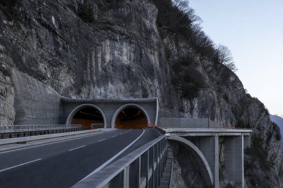
This page records the structures catalogued along the SS33 in Italy, in a tunnel almanac maintained at this address since the late 1990s. Laid end to end the entries on this page would run 13.19 km, which is a number with no engineering meaning but a useful sense of the scale of what is catalogued.
The next two longest are Gabbio at 1.6 km and Toce at 1.27 km. A tunnel list for Italy reads differently from a neighbouring country's: 0 of these 37 structures pass three kilometres, and the same journey time is bought with one long bore in one country and a dozen short ones in another.
The entries sum to roughly 13.19 km of bore, an average of about 0.36 km each, though that average describes no actual row. A new scheme in Italy would have to beat 2.25 km to change the head of this table, and that is the figure worth rechecking when one opens.
Questions about Italy
What is the longest structure in Italy?
On the figures recorded here it is Montecrevola, at 2.25 km. It is the longest of the 37 entries recorded here, measured by bore length rather than span, cost or construction difficulty.
How many structures are listed for Italy?
37 entries with a recorded length appear on this page, from 0.02 km at the short end to 2.25 km at the top, with the middle of the set around 0.19 km. The table renders 49 rows in total; the rest carry a note or a blank where a length belongs.
What is a typical length among the structures listed for Italy?
The median entry measures 0.19 km and the middle half of the table runs from 0.08 km to 0.39 km. The headline figure of 2.25 km is the outlier, not the norm, which is why the median is the more useful number when comparing one national list against another.
How close is the top of the Italy table?
The longest stands 0.65 km clear of the next entry, and nothing else comes within ten per cent of it. A newly announced scheme therefore has to beat 2.25 km to displace Montecrevola.
How many structures does this route carry?
36 named tunnels and viaducts have a recorded length on this route, the longest being Montecrevola at 2.25 km, followed by Gabbio at 1.6 km and Toce at 1.27 km; 28 of the 36 are under 500 metres.
Other pages in this section
- Structures on the A1 var: the Variante di Valico, Bologna to Firenze
- Tunnels and Viaducts on the A01 Motorway in Italy, by Kilometre Point
- Tunnels and Viaducts on the A02 Motorway in Italy, by Kilometre Point
- Tunnels and Viaducts on the A03 Motorway in Italy, by Kilometre Point
- Tunnels and Viaducts on the A04 Motorway in Italy, by Kilometre Point
- Tunnels and Viaducts on the A05 Motorway in Italy, by Kilometre Point
- Tunnels and Viaducts on the A06 Motorway in Italy, by Kilometre Point
- Tunnels and Viaducts on the A07 Motorway in Italy, by Kilometre Point
- Tunnels and Viaducts on the A08 Motorway in Italy, by Kilometre Point
- Tunnels and Viaducts on the A09 Motorway in Italy, by Kilometre Point
- Tunnels and Viaducts on the A10 Motorway in Italy, by Kilometre Point
- Tunnels and Viaducts on the A11 Motorway in Italy, by Kilometre Point
- Tunnels and Viaducts on the A12 Motorway in Italy, by Kilometre Point
- Tunnels and Viaducts on the A13 Motorway in Italy, by Kilometre Point
- Tunnels and Viaducts on the A14 Motorway in Italy, by Kilometre Point
- Tunnels and Viaducts on the A15 Motorway in Italy, by Kilometre Point
- Tunnels and Viaducts on the A16 Motorway in Italy, by Kilometre Point
- Tunnels and Viaducts on the A18 Motorway in Italy, by Kilometre Point
- Tunnels and Viaducts on the A19 Motorway in Italy, by Kilometre Point
- Tunnels and Viaducts on the A20 Motorway in Italy, by Kilometre Point
- Tunnels and Viaducts on the A21 Motorway in Italy, by Kilometre Point
- Tunnels and Viaducts on the A22 Motorway in Italy, by Kilometre Point
- Tunnels and Viaducts on the A23 Motorway in Italy, by Kilometre Point
- Tunnels and Viaducts on the A24 Motorway in Italy, by Kilometre Point
- Tunnels and Viaducts on the A25 Motorway in Italy, by Kilometre Point
- Tunnels and Viaducts on the A26 Motorway in Italy, by Kilometre Point
- Tunnels and Viaducts on the A27 Motorway in Italy, by Kilometre Point
- Tunnels and Viaducts on the A28 Motorway in Italy, by Kilometre Point
- Tunnels and Viaducts on the A29 Motorway in Italy, by Kilometre Point
- Tunnels and Viaducts on the A30 Motorway in Italy, by Kilometre Point
- Tunnels and Viaducts on the A31 Motorway in Italy, by Kilometre Point
- Tunnels and Viaducts on the A32 Motorway in Italy, by Kilometre Point
- Tunnels and Viaducts on the A33 Motorway in Italy, by Kilometre Point
- Tunnels and Viaducts on the A34 Motorway in Italy, by Kilometre Point
- Tunnels and Viaducts on the A35 Motorway in Italy, by Kilometre Point
- Tunnels and Viaducts on the A36 Motorway in Italy, by Kilometre Point
- Tunnels and Viaducts on the A4-A31-A27 Motorway, by Kilometre Point
- Tunnels and Viaducts on the A50 Motorway in Italy, by Kilometre Point
- Tunnels and Viaducts on the A51 Motorway in Italy, by Kilometre Point
- Tunnels and Viaducts on the A52 Motorway in Italy, by Kilometre Point
- Tunnels and Viaducts on the A58 Motorway in Italy, by Kilometre Point
- Tunnels and Viaducts on the A90 Motorway in Italy, by Kilometre Point
- Tunnels and Viaducts on the D08 Motorway in Italy, by Kilometre Point
- Tunnels and Viaducts on the D11 Motorway in Italy, by Kilometre Point
- Tunnels and Viaducts on the D15 Motorway in Italy, by Kilometre Point
- Tunnels and Viaducts on the D29 Motorway in Italy, by Kilometre Point
- Tunnels and Viaducts on the D29A Motorway in Italy, by Kilometre Point
- Traforo del Monte Bianco: the Mont Blanc Tunnel Reopened in 2002
- Tunnels and Viaducts on the R03 Motorway in Italy, by Kilometre Point
- Tunnels and Viaducts on the R04 Motorway in Italy, by Kilometre Point
- Tunnels and Viaducts on the R30 Motorway in Italy, by Kilometre Point
- Tunnels and Viaducts on the R33 Motorway in Italy, by Kilometre Point
- Tunnels on the Italian State Roads SS 100 to SS 199, Listed by Route
- Tunnels and Viaducts on the S.S. 125 var, Cagliari to Tortoli
- Tunnels and Viaducts on the SS340 in Italy, by Kilometre Point
- Tunnels and Viaducts on the SS36 Motorway in Italy, by Kilometre Point
- Tunnels and Viaducts on the SS38 Motorway in Italy, by Kilometre Point
- Tunnels and Viaducts on the TEM — Tangenziale Esterna Est Milano
- Motorways' Chronology in Italy — Section Openings Listed by Date
- Motorways in Italy, Page 2 — Tunnels and Viaducts by Kilometre Point
- Motorways in Italy — the Numbering Scheme, Routes and Structures
- The Furlo Tunnel in Italy: Portals, Photographs and Setting
- Road Tunnels in Italy — Complete List by Length, Part 1000
- Road Tunnels in Italy — Complete List by Length, Part 750
- Road Tunnels in Italy — Complete List by Length
Cite this page
Tunnels and Viaducts on the SS33 Motorway in Italy, by Kilometre Point. The World's Longest Tunnels. https://www.lotsberg.net/data/italia/SS33.html
Related record tables
- Structures on the A1 var, Variante di Valico, Italy
- Tunnels and Viaducts on the A01 Motorway in Italy
- Tunnels and Viaducts on the A02 Motorway in Italy
- Tunnels and Viaducts on the A03 Motorway in Italy
- Tunnels and Viaducts on the A04 Motorway in Italy
- Tunnels and Viaducts on the A05 Motorway in Italy
- Tunnels and Viaducts on the A06 Motorway in Italy
- Tunnels and Viaducts on the A07 Motorway in Italy
- Tunnels and Viaducts on the A08 Motorway in Italy
- Tunnels and Viaducts on the A09 Motorway in Italy
- Tunnels and Viaducts on the A10 Motorway in Italy
- Tunnels and Viaducts on the A11 Motorway in Italy