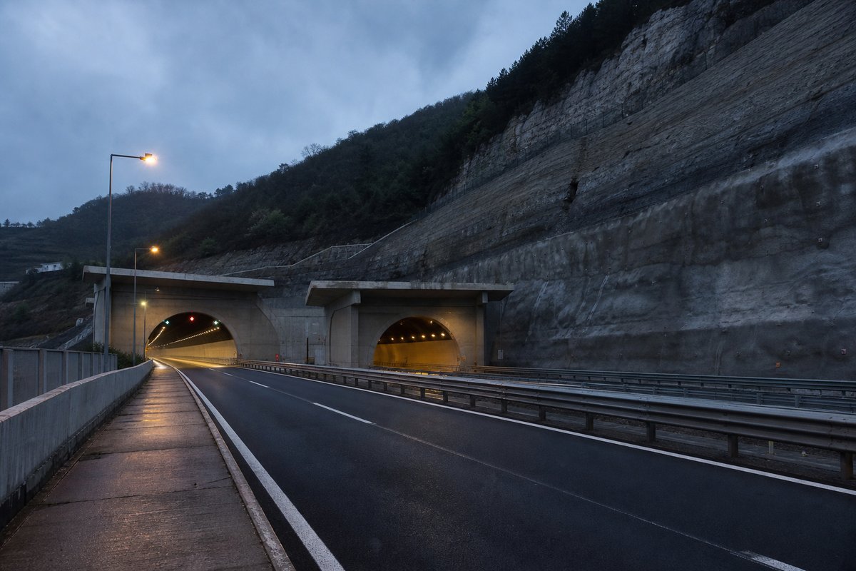
274 rows are rendered in total, so 114 of them carry a note or a blank where a length belongs and are shown without being counted. The middle half of the table runs from 0.14 km to 0.46 km, and that band is where most of the engineering on this page actually sits.
The median entry measures 0.25 km, so half the table sits below that and half above, which is a better guide to the typical structure here than the headline figure. The shortest recorded entry is 0.05 km against 1.46 km at the top, a spread of 30.42x across the same table.
150 entries fall below a kilometre, short enough that portals and approaches usually decided their cost more than the bore itself. Alento at 1.31 km and Solagne at 1.28 km follow it, and lengths are given per carriageway because the two bores of a dual route are rarely cut to the same length.
- 160entries listed
- 1.46 kmlongest bore
- 57.89 kmtotal length
The record table
How this archive measures: lengths, bores, dates and ordering
| Tunnel / Viaduct | Direction Taranto | Direction Bologna | Notes | km |
|---|---|---|---|---|
| Reg. Emilia Romagna – Prov. BO | ||||
| Connection A1 Milano - Napoli | 0+000 | |||
| Shell | Agip | Service Areas "La Pioppa" | 2+300 | |
| Exit Bologna Borgo Panigale | 4+800 | |||
| Connection RA01 Bologna Casalecchio – A1 | 9+000 | |||
| Reno | 496 m | 496 m | ||
| Connection A13 Padova – Exit Bologna Arcoveggio | 14+400 | |||
| Exit Bologna Fiera | ||||
| San Donino* | 290 m | - | Noise barrier tunnel | |
| Exit Bologna San Lazzaro | 22+200 | |||
| Molini | 10 m | 10 m | ||
| Idice | 10 m | 10 m | ||
| Agip | IP | Service Areas "Sillaro" | 37+500 | |
| Exit Castel San Pietro Terme | 38+100 | |||
| Sillaro | 130 m | 130 m | ||
| Exit Imola | 50+100 | |||
| Prov. BO - RA | ||||
| ConnectionD14 (A14dir) Ravenna | 56+700 | |||
| Total | Esso | Service Areas "Santerno" | 59+500 | |
| Exit Faenza | 64+500 | |||
| Prov. RA - FC | ||||
| Exit Forlì | 81+600 | |||
| Esso | Agip | Service Areas "Bevano" | 89+500 | |
| Exit Cesena Nord | 93+600 | |||
| Exit Cesena | 99+700 | |||
| Shell | IP | Service Areas "Rubicone" | 111+300 | |
| Prov. FC - RN | ||||
| Exit Rimini Nord – Bellaria – S.Arcangelo | 117+300 | |||
| Marecchia | 216 m | 216 m | ||
| Torrente Ausa | 116 m | 116 m | ||
| Exit Rimini Sud | 127+400 | |||
| Agip | Q8 | Service Areas "Montefeltro" | 133+500 | |
| Exit Riccione | 135+400 | |||
| Scacciano | 225 m | 255 m | ||
| Conca | 232 m | 232 m | ||
| Exit Cattolica-San Giovanni Marignano - Gabicce | 143+900 | |||
| Reg.Emilia Romagna-Marche; prov.RN - PU | ||||
| Del Boncio | 175 m | 175 m | 151+841 | |
| Case Bruciate | 130 m | 130 m | 155+168 | |
| Exit Pesaro - Urbino | 155+900 | |||
| Foglia | 168 m | 168 m | ||
| Shell | Agip | Service Areas "Foglia" | 158+900 | |
| Exit Pesaro Centro | ||||
| Santa Veneranda | 153 m | 153 m | ||
| Colombaraccia | 201 m | 201 m | ||
| Rio Condotti | 134 m | 134 m | ||
| Novilara | 285 m (812 m) | 280 m (285 m) | 164+470 | |
| Exit Fano Nord | ||||
| Exit Fano – Connection R05 | 173+300 | |||
| Metauro | 368 m | 368 m | ||
| Exit Marotta - Mondolfo | 185+400 | |||
| IP | IP | Service Areas "Metauro" | 186+200 | |
| Cesano | 268 m | 268 m | Prov. PU - AN | |
| Misa | 100 m | 100 m | ||
| Exit Senigallia | 194+500 | |||
| Del Cavallo | 501 m | 499 m | 196+502 | |
| Morignano | 469 m | 469 m | ||
| La Gabriella | 101 m | 101 m | ||
| Exit Marina di Montemarciano | ||||
| Esso | Agip | Service Areas "Esino" | 208+700 | |
| Esino | 201 m | 201 m | ||
| Exit Ancona Nord | 213+500 | |||
| Montedomini | 283 m | 278 m | 215+223 | |
| Exit Ancona Ovest | ||||
| Sappanico | 862 m | 892 m | 222+557 | |
| Exit Ancona Sud - Osimo | 230+400 | |||
| S.S. 16 | 160 m | 145 m | ||
| Agip | Shell | Service Areas "Conero" | 239+000 | |
| Aspio III | 80 m | |||
| Musone | 110 m | 110 m | Prov. AN - MC | |
| Ferrovia Ancona Pescara | 126 m | 126 m | Prov. MC - AN | |
| Exit Loreto – Porto Recanati | 245+500 | |||
| Potenza | 268 m | 268 m | Prov. AN - MC | |
| Fosso Mare | 260 m | 236 m | ||
| Fosso Caronte | 167 m | 167 m | ||
| Fosso Castellaro | 268 m | 268 m | ||
| Exit Macerata- Civitanova Marche | 262+600 | |||
| Chienti | 188 m | 188 m | ||
| Q8 | Total | Service Areas "Chienti" | 263+900 | |
| Ete Morto | 70 m | 70 m | ||
| Prov. MC - FM | ||||
| Fosso Castellano III | 218 m | 218 m | ||
| Fosso Castellano II | 291 m | 291 m | ||
| Fosso Pescolla | 120 m | 120 m | ||
| Fonte Serpe II | 181 m (190 m) | 185 m | ||
| Fonte Serpe III | 180 m (190 m) | 180 m | ||
| Corva | 150 m | 150 m | 267+831 | |
| Fosso dell’Albero | 510 m | 510 m | ||
| Exit Porto Sant'Elpidio | ||||
| Tenna | 165 m | 165 m | ||
| Fosso Vallescura | 291 m (300 m) | 291 m | ||
| Ennio | 301 m (310 m) | 303 m | ||
| Fosso Petronilla | 380 m | 400 m | ||
| Porto San Giorgio | 854 m (860 m) | 847 m | 278+181 | |
| Exit Fermo - Porto S.Giorgio | 280+000 | |||
| Fosso della Torre | 110 | 110 | ||
| San Biagio | 135 (140 m) | 135 | ||
| Aso | 135 (140 m) | 135 | ||
| Exit Pedaso | 288+100 | |||
| Pedaso | 1 076 m (1 080 m) | 1 087 m (1 090 m) | 288+888 | |
| Pedaso | 60 m | 80 m | ||
| Campofilone | 165 m (170 m) | 165 m (170 m) | ||
| Shell | Agip | Service Areas "Piceno" | 290+800 | |
| Rio Canale | 441 m (450 m) | 462 m (470 m) | Prov. FM - AP | |
| Fosso Santa Giuliana | 198 m (200 m) | 198 m (200 m) | ||
| Vinci | 391 m | 391 m | 293+298 | |
| Mennocchia | 210 m | 210 m | ||
| San Basso | 846 m (850 m) | 846 m (850 m) | 295+782 | |
| Sant’Egidio | 238 m (240 m) | 238 m (240 m) | ||
| Castello di Cupramarittima | 1 130 m | 1 097 m (1 100 m) | 297+131 | |
| Fosso Sant’Andrea | 102 m (110 m) | 121 m (130 m) | ||
| Acquarossa | 435 m (440 m) | 415 m (420 m) | 298+024 | |
| San Cipriano | 610 m | 572 m (590 m) | 298+659 | |
| Fosso San Cipriano | 79 m (80 m) | 197 m (200 m) | ||
| Fosso Santa Lucia | 60 m | 80 m | ||
| Castello di Grottammare | 1 227 m (1250 m) | 1 229 m | 300+302 | |
| Exit Grottammare | 301+700 | |||
| Tesino | 172 m (170 m) | 162 m (170 m) | ||
| Montesecco | 760 m | 770 m | 302+441 | |
| - | P | Parking Area "Le Terrazze" | ||
| Fosso delle Tavole | 70 m | 70 m | ||
| Fosso Spariglia | 235 m (240 m) | 235 m (240 m) | ||
| Torrente Albula | 336 m (340 m) | 336 m (340 m) | ||
| Valle del Forno | 168 m (170 m) | 168 m (170 m) | ||
| Croce di San Benedetto | 628 m (630 m) | 648 m (650 m) | 306+051 | |
| Fosso Acquachiara | 100 m (110 m) | 110 m | ||
| Ramadini | 116 m (120 m) | 116 m (120 m) | ||
| Ragnola | 402 m (410 m) | 402 m (410 m) | ||
| Monterenzo | 864 m (870 m) | 867 m (870 m) | 309+059 | |
| Exit San Benedetto d.Tronto – Connection RA11 Ascoli Piceno | 311+700 | |||
| Tronto | 611 m (620 m) | 644 m | Reg. Marche -Abruzzo; Prov.AP - TE | |
| Colle di Marzio | 622 m (630 m) | 602 m | 312+849 | |
| S.P. Colonnella | 100 m | 100 m | ||
| Exit Val Vibrata | 319+000 | |||
| Vibrata | 110 m | 110 m | ||
| Tamoil | Esso | Service Areas "Tortoreto" | 323+600 | |
| Salinello | 1 454 m (1 460 m) | 1 454 m (1 460 m) | ||
| Fosso Gabbiano | 393 m | 393 m | ||
| Exit Teramo -Giulianova – Mosciano S.Angelo | 334+400 | |||
| S.S. 80 - FS Teramo-Giulianova | 100 m | 80 m | ||
| Tordino | 201 m (200 m) | 201 m (200 m) | ||
| San Marco | 955 m (980 m) | 765 m (770 m) | 337+848 | |
| Agip | TotalErg | Service Areas "Vomano" | 340+300 | |
| S.S. 150 "del Vomano" | 60 m | 60 m | ||
| Exit Roseto | 344+000 | |||
| Vomano | 469 m (470 m) | 469 m (470 m) | ||
| Colle Marino | 1 004 m (1010 m) | 951 m (960 m) | 347+227 | |
| SP Atri – Pineto | 134 m (140 m) | 134 m (140 m) | ||
| Exit Atri - Pineto | 351+800 | |||
| Colle Pino | 586 m (590 m) | 591 m (600 m) | 352+873 | |
| Santa Maria | 805 m (810 m) | 805 m (810 m) | ||
| Solagne | 1 258 m (1 260 m) | 1 278 m (1 280 m) | 354+794 | |
| Cerrano | 805 m (810 m) | 805 m (810 m) | ||
| - | P | Parking Area "Fonte Antica Est" | ||
| Fonte da Capo | 481 m (490 m) | 508 m (510 m) | 357+320 | |
| P | - | Parking Area "Fonte Antica Ovest" | ||
| Pianacce | 966 m (970 m) | 966 m (970 m) | 358+463 | |
| Fosso Marinelli | 100 m (110 m) | 100 m (110 m) | ||
| Esso | Agip | Service Areas "Torre Cerrano" | 363+100 | |
| Torrente Piomba | 100 m (110 m) | 100 m (110 m) | ||
| Exit Città S.Angelo / Pescara Nord | 364+200 | |||
| Saline | 160 m | 160 m | Prov. TE - PE | |
| Cappelle | 554 m (560 m) | 696 m | 371+390 | |
| Villanova | 83 m (90 m) | 83 m | 377+141 | |
| Connection A25 Torano | 378+400 | |||
| Pescara | 259 m (260 m) | 259 m | Prov. PE - CH | |
| Exit Pescara Ovest - Chieti / Connection RA12 Chieti-S.S.16 | 380+800 | |||
| San Giovanni | 213 m | 216 m | Prov. CH | 382+350 |
| Colle Rotondo | 111 m (120 m) | 119 m | 385+295 | |
| Vallelunga | 267 m | 312 m | ||
| Immacolata | 562 m (580 m) | - | 386+023 | |
| Immacolata-Vaccari | - | 910 m | 386+213 | |
| Vaccari | 137 m | - | 386+596 | |
| P | P | Parking Areas "Le Sirene" | ||
| Alento | 1 305 m (1 310 m) | 1 305 m | ||
| Colle Moretto | 388 m (390 m) | 382 m | 390+410 | |
| Valle Bona | 450 m | 450 m | ||
| Exit Pescara Sud-Francavilla | 392+600 | |||
| Eni | Shell | Service Areas "Alento" | 393+900 | |
| Foro | 1 169 m (1 170 m) | 1 170 m | ||
| Cremona | - | 135 m | ||
| Lazzaretto | 48 m | One tube, 4 lanes | 396+390 | |
| San Clerico | 120 m | 120 m | ||
| Arielli | 585 m (590 m) | 585 m | ||
| Lupo | 226 m | 226 m | ||
| Brusciano | 197 m (200 m) | 197 m (200 m) | ||
| Riccio II | 225 m (230 m) | 226 m (230 m) | ||
| Riccio III | 360 m | 360 m | ||
| Exit Ortona | 404+600 | |||
| Saraceni | 180 m | 180 m | ||
| Moro | 1 125 m (1 130 m) | 1 125 m (1130 m) | ||
| Sant'Angelo | 225 m (230 m) | 225 m (230 m) | ||
| Feltrino | 1 260 m | 1 260 m | ||
| Exit Lanciano | 414+000 | |||
| Fontanelle | 320 m | 320 m | ||
| Novella | 135 m (140 m) | 135 m (140 m) | ||
| Carburo | 360 m | 360 m | ||
| Foce | 180 m | 180 m | ||
| Sterpari | 168 m (180 m) | 180 m | ||
| Fonte de' Preti | 270 m | 270 m | ||
| Exit Val di Sangro | 422+000 | |||
| Sangro | 236 m (240 m) | 336 m | ||
| Osento | 140 m | 100 m | ||
| Q8 | IP | Service Areas "Sangro" | 428+800 | |
| San Savino | 313 m (320 m) | 313 m | 429+617 | |
| Acquachiara | 315 m | 315 m | ||
| Passo di Coccia | 115 m | 115 m | ||
| Selvotta | 315 m | 315 m | ||
| Pozzacchio | 280 m | 270 m | ||
| Difesa Vecchia | 156 m (160 m) | 156 m | ||
| Exit Vasto Nord - Casalbordino | 437+300 | |||
| Sinello | 312 m | 312 m | ||
| P | P | Parking Areas "San Lorenzo" | ||
| Codalfa | 267 m (270 m) | 267 m | ||
| Prascovia | 505 m | 505 m | ||
| Vallone Ilde | 474 m (480 m) | 475 m | 447+469 | |
| Fosso di Franco | 372 m (380 m) | 372 m | ||
| Giustina | 404 m (410 m) | 404 m | ||
| Bonanotte | 272 m | 272 m | ||
| Reg.Abruzzo - Molise; prov. CH - CB; | 454+600 | |||
| Exit Montenero di Bisaccia - Vasto Sud | ||||
| Ferrovia Bologna Lecce | 168 m | 168 m | ||
| Trigno | 400 m | 400 m | ||
| Tamoil | Eni | Service Areas "Trigno" | 458+600 | |
| Mergolo | 229 m (230 m) | 229 m | ||
| Tecchio | 333 m (340 m) | 333 m | ||
| Cacchione | 67 m (70 m) | 67 m | ||
| Marinella | 333 m (340 m) | 333 m | ||
| Sinarca | 135 m (140 m) | 135 m | ||
| Tamoil | Tamoil | Service Areas "Rio Vivo" | 474+000 | |
| Rio Vivo | 629 m (630 m) | 629 m | ||
| La Gatta | 224 m (230 m) | 224 m | ||
| Exit Termoli | 477+000 | |||
| FS Termoli - Campobasso | 117 m | 117 m | ||
| IP | Tamoil | Service Areas "Torre Fantine" | 493+000 | |
| Biferno | 899 m | 899 m | ||
| Saccione | 337 m | 337 m | Reg.Molise – Puglia; Prov. CB – FG | |
| Fortore | 167 m | 167 m | ||
| Exit Poggio Imperiale - Lesina | 508+000 | |||
| Esso | Tamoil | Service Areas "San Trifone" | 517+000 | |
| Exit San Severo | 529+600 | |||
| Triolo | 145 m | 145 m | ||
| Q8 | Tamoil | Service Areas "Gargano" | 542+000 | |
| Exit Foggia | 555+000 | |||
| Tamoil | Tamoil | Service Areas "Daunia" | 560+000 | |
| Cervaro | 130 m | 130 m | ||
| Carapelle | 160 m | 160 m | ||
| Q8 | Esso | Service Areas "Le Saline" | 587+000 | |
| Exit Cerignola Est | 590+100 | |||
| Ofanto | 370 m | 370 m | Connection A16 Napoli | 603+500 |
| Prov. FG - BT | ||||
| Exit Canosa | 611+300 | |||
| P | P | Parking Areas "Monterotondo" | 616+300 | |
| Eni | Q8 | Service Areas "Canne della Battaglia" | 620+000 | |
| Exit Andria – Barletta | 627+700 | |||
| Exit Trani | 638+900 | |||
| Tamoil | Esso | Service Areas "Dolmen di Bisceglie" | 644+000 | |
| Prov. BT - BA | ||||
| Exit Molfetta | 653+200 | |||
| Exit Bitonto | 663+800 | |||
| Esso | Eni | Service Areas "Murge" | 671+000 | |
| Exit Bari Nord – Connetion D94 | 673+000 | |||
| Exit Bari Sud | 678+600 | |||
| P | P | Parking Areas "Virgilio" | 689+100 | |
| Q8 | Tamoil | Service Areas "Le Fonti" | 698+000 | |
| Exit Acquaviva delle Fonti | 698+400 | |||
| P | - | Parking Area "Le Masserie Est" | 700+600 | |
| Exit Gioia del Colle | 710+300 | |||
| Prov. BA - TA | ||||
| P | P | Parking Areas "Le Grotte" | 722+700 | |
| Exit Mottola – Castellaneta | 724+600 | |||
| P | P | Parking Areas "La Pineta" | 731+500 | |
| Toll station Taranto Nord | 735+900 | |||
| TOTAL tunnels | 19 162 | 19 691 |
How this table is compiled
The 258 entries are grouped on the page under 16 headings — exit porto sant'elpidio (131), exit montenero di bisaccia - vasto sud (29), exit ancona ovest (16), exit fano nord (10) and prov. bt - ba (10) — a classification the table carries as section breaks rather than as a column of its own.
The route table lists 160 structures with a recorded length, giving both carriageways where the two bores differ. The table on this page runs to 258 rows and records Tunnel / Viaduct, Direction Taranto, Direction Bologna, Notes and km for each of them, which is the shape the original compiler chose rather than one imposed here.
The three longest entries alone account for 4.05 km of the 57.89 km on this page, which is 7 per cent of the total from 3 of 160 rows. 80 entries sit above the median and 80 at or below it, so the table is evenly weighted and not clustered at one end.
This page records the structures catalogued along the A14 in Italy, in a tunnel almanac maintained at this address since the late 1990s. The captions name 33 distinct places and structures — Nord, Connection and Abruzzo among them — and those names are the index into the length tables where each is recorded with its own figure.
Between the longest and the tenth-longest the drop is 0.45 km, which is the part of the table that changes when a single scheme opens. Where one of these 160 lengths disagrees with an operator's own figure for Italy, the table keeps the published value and notes the difference instead of averaging the two.
Reading the figures
Lengths for Italy are recorded in metres which is how the operators publish them and why the shortest entry here reads as 48 m and not a rounded figure. The longest entry is 30.4 times the shortest and 5.9 times the median, which is the quickest measure of how uneven the table is.
A new scheme in Italy would have to beat 1.46 km to change the head of this table, and that is the figure worth rechecking when one opens. The eighth longest is Moro at 1.13 km, which is about where this record stops being about record holders and starts being about ordinary infrastructure.
The shorter half of the table totals 12.07 km against 45.82 km for the longer half, from the same number of rows. Only 126 of the 258 rows carry anything in the km column, so that field describes a minority of this table and the rest of the rows are recorded without it.
The material on this page is held in 21 captions rather than in running text, 132 words of it, each written against the image or row it belongs to by the compiler who put the page together. The kilometre point is recorded for each structure on the A14, which is how the operator identifies it.
The next two longest are Alento at 1.31 km and Solagne at 1.26 km. A tunnel list for Italy reads differently from a neighbouring country's: 0 of these 160 structures pass three kilometres, and the same journey time is bought with one long bore in one country and a dozen short ones in another.
Questions about Italy
What is the longest structure in Italy?
On the figures recorded here it is Salinello, at 1.46 km. It is the longest of the 160 entries recorded here, measured by bore length rather than span, cost or construction difficulty.
How many structures are listed for Italy?
160 entries with a recorded length appear on this page, from 0.05 km at the short end to 1.46 km at the top, with the middle of the set around 0.25 km. The table renders 274 rows in total; the rest carry a note or a blank where a length belongs.
What is a typical length among the structures listed for Italy?
The median entry measures 0.25 km and the middle half of the table runs from 0.14 km to 0.46 km. The headline figure of 1.46 km is the outlier, not the norm, which is why the median is the more useful number when comparing one national list against another.
How close is the top of the Italy table?
The longest stands 0.15 km clear of the next entry, and nothing else comes within ten per cent of it. A newly announced scheme therefore has to beat 1.46 km to displace Salinello.
How many structures does this route carry?
160 named tunnels and viaducts have a recorded length on this route, the longest being Salinello at 1.46 km, followed by Alento at 1.31 km and Solagne at 1.28 km; 125 of the 160 are under 500 metres.
Other pages in this section
- Structures on the A1 var: the Variante di Valico, Bologna to Firenze
- Tunnels and Viaducts on the A01 Motorway in Italy, by Kilometre Point
- Tunnels and Viaducts on the A02 Motorway in Italy, by Kilometre Point
- Tunnels and Viaducts on the A03 Motorway in Italy, by Kilometre Point
- Tunnels and Viaducts on the A04 Motorway in Italy, by Kilometre Point
- Tunnels and Viaducts on the A05 Motorway in Italy, by Kilometre Point
- Tunnels and Viaducts on the A06 Motorway in Italy, by Kilometre Point
- Tunnels and Viaducts on the A07 Motorway in Italy, by Kilometre Point
- Tunnels and Viaducts on the A08 Motorway in Italy, by Kilometre Point
- Tunnels and Viaducts on the A09 Motorway in Italy, by Kilometre Point
- Tunnels and Viaducts on the A10 Motorway in Italy, by Kilometre Point
- Tunnels and Viaducts on the A11 Motorway in Italy, by Kilometre Point
- Tunnels and Viaducts on the A12 Motorway in Italy, by Kilometre Point
- Tunnels and Viaducts on the A13 Motorway in Italy, by Kilometre Point
- Tunnels and Viaducts on the A15 Motorway in Italy, by Kilometre Point
- Tunnels and Viaducts on the A16 Motorway in Italy, by Kilometre Point
- Tunnels and Viaducts on the A18 Motorway in Italy, by Kilometre Point
- Tunnels and Viaducts on the A19 Motorway in Italy, by Kilometre Point
- Tunnels and Viaducts on the A20 Motorway in Italy, by Kilometre Point
- Tunnels and Viaducts on the A21 Motorway in Italy, by Kilometre Point
- Tunnels and Viaducts on the A22 Motorway in Italy, by Kilometre Point
- Tunnels and Viaducts on the A23 Motorway in Italy, by Kilometre Point
- Tunnels and Viaducts on the A24 Motorway in Italy, by Kilometre Point
- Tunnels and Viaducts on the A25 Motorway in Italy, by Kilometre Point
- Tunnels and Viaducts on the A26 Motorway in Italy, by Kilometre Point
- Tunnels and Viaducts on the A27 Motorway in Italy, by Kilometre Point
- Tunnels and Viaducts on the A28 Motorway in Italy, by Kilometre Point
- Tunnels and Viaducts on the A29 Motorway in Italy, by Kilometre Point
- Tunnels and Viaducts on the A30 Motorway in Italy, by Kilometre Point
- Tunnels and Viaducts on the A31 Motorway in Italy, by Kilometre Point
- Tunnels and Viaducts on the A32 Motorway in Italy, by Kilometre Point
- Tunnels and Viaducts on the A33 Motorway in Italy, by Kilometre Point
- Tunnels and Viaducts on the A34 Motorway in Italy, by Kilometre Point
- Tunnels and Viaducts on the A35 Motorway in Italy, by Kilometre Point
- Tunnels and Viaducts on the A36 Motorway in Italy, by Kilometre Point
- Tunnels and Viaducts on the A4-A31-A27 Motorway, by Kilometre Point
- Tunnels and Viaducts on the A50 Motorway in Italy, by Kilometre Point
- Tunnels and Viaducts on the A51 Motorway in Italy, by Kilometre Point
- Tunnels and Viaducts on the A52 Motorway in Italy, by Kilometre Point
- Tunnels and Viaducts on the A58 Motorway in Italy, by Kilometre Point
- Tunnels and Viaducts on the A90 Motorway in Italy, by Kilometre Point
- Tunnels and Viaducts on the D08 Motorway in Italy, by Kilometre Point
- Tunnels and Viaducts on the D11 Motorway in Italy, by Kilometre Point
- Tunnels and Viaducts on the D15 Motorway in Italy, by Kilometre Point
- Tunnels and Viaducts on the D29 Motorway in Italy, by Kilometre Point
- Tunnels and Viaducts on the D29A Motorway in Italy, by Kilometre Point
- Traforo del Monte Bianco: the Mont Blanc Tunnel Reopened in 2002
- Tunnels and Viaducts on the R03 Motorway in Italy, by Kilometre Point
- Tunnels and Viaducts on the R04 Motorway in Italy, by Kilometre Point
- Tunnels and Viaducts on the R30 Motorway in Italy, by Kilometre Point
- Tunnels and Viaducts on the R33 Motorway in Italy, by Kilometre Point
- Tunnels on the Italian State Roads SS 100 to SS 199, Listed by Route
- Tunnels and Viaducts on the S.S. 125 var, Cagliari to Tortoli
- Tunnels and Viaducts on the SS33 Motorway in Italy, by Kilometre Point
- Tunnels and Viaducts on the SS340 in Italy, by Kilometre Point
- Tunnels and Viaducts on the SS36 Motorway in Italy, by Kilometre Point
- Tunnels and Viaducts on the SS38 Motorway in Italy, by Kilometre Point
- Tunnels and Viaducts on the TEM — Tangenziale Esterna Est Milano
- Motorways' Chronology in Italy — Section Openings Listed by Date
- Motorways in Italy, Page 2 — Tunnels and Viaducts by Kilometre Point
- Motorways in Italy — the Numbering Scheme, Routes and Structures
- The Furlo Tunnel in Italy: Portals, Photographs and Setting
- Road Tunnels in Italy — Complete List by Length, Part 1000
- Road Tunnels in Italy — Complete List by Length, Part 750
- Road Tunnels in Italy — Complete List by Length
Cite this page
Tunnels and Viaducts on the A14 Motorway in Italy, by Kilometre Point. The World's Longest Tunnels. https://www.lotsberg.net/data/italia/A14.html
Related record tables
- Structures on the A1 var, Variante di Valico, Italy
- Tunnels and Viaducts on the A01 Motorway in Italy
- Tunnels and Viaducts on the A02 Motorway in Italy
- Tunnels and Viaducts on the A03 Motorway in Italy
- Tunnels and Viaducts on the A04 Motorway in Italy
- Tunnels and Viaducts on the A05 Motorway in Italy
- Tunnels and Viaducts on the A06 Motorway in Italy
- Tunnels and Viaducts on the A07 Motorway in Italy
- Tunnels and Viaducts on the A08 Motorway in Italy
- Tunnels and Viaducts on the A09 Motorway in Italy
- Tunnels and Viaducts on the A10 Motorway in Italy
- Tunnels and Viaducts on the A11 Motorway in Italy