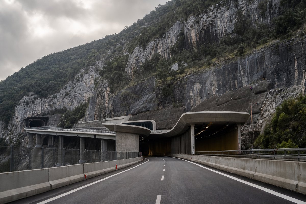
480 rows are rendered in total, so 101 of them carry a note or a blank where a length belongs and are shown without being counted. The middle half of the table runs from 0.09 km to 0.35 km, and that band is where most of the engineering on this page actually sits.
The median entry measures 0.17 km, so half the table sits below that and half above, which is a better guide to the typical structure here than the headline figure. The shortest recorded entry is 0.02 km against 3.88 km at the top, a spread of 193.80x across the same table.
358 entries fall below a kilometre, short enough that portals and approaches usually decided their cost more than the bore itself. Barritteri at 2.66 km and Iannello at 2.34 km follow it, and lengths are given per carriageway because the two bores of a dual route are rarely cut to the same length.
- 379entries listed
- 3.88 kmlongest bore
- 117.09 kmtotal length
The record table
How this archive measures: lengths, bores, dates and ordering
| Tunnel / Viaduct | Direction Reggio C. | Direction Fisciano | Notes |
|---|---|---|---|
| Reg. Campania – Prov. SA | |||
| Connection A30 Napoli; Connection RA2 Avellino | |||
| Exit Fisciano-Università (from and to Reggio Calabria) | |||
| - | Exit Lancusi | ||
| - | Exit Lancusi | ||
| IP | IP | Service areas "Baronissi" | |
| Exit Baronissi | |||
| Sava | 169 m | 130 m | |
| Spinacavallo | 89 m | 89 m | |
| Cologna | 200 m | 200 m | |
| Spetrini | 50 m | 50 m | |
| Connection A2dirNA Napoli | |||
| Brignano I | 408 m | 306 m | |
| Brignano II | 102 m | 68 m | |
| Rufoli | 577 m | 639 m | |
| eni | eni | Service areas "Salerno" | |
| Exit San Mango Piemonte | |||
| Fuorni | 240 m | 300 m | |
| Montevetrano I | 780 m | 840 m | |
| Montevetrano II | 710 m | 710 m | Open on 11.03.02 |
| Exit Pontecagnano Nord | |||
| Picentino | 60 m | 60 m | |
| Asa | 89 m | 89 m | |
| Exit Pontecagnano Sud - Montecorvino | |||
| Diavolone | 37 m | 37 m | |
| Voltaladri | 24 m | 24 m | |
| Bufale | 24 m | 24 m | |
| Lama | 24 m | 24 m | |
| Vallemonio | 24 m | 24 m | |
| Exit Battipaglia | |||
| Tusciano | 71 m | 71 m | |
| Cimitero | 70 m | 70 m | |
| Cave I | 15 m | 15 m | |
| Cave II | 20 m | 20 m | |
| Sottopasso FFSS | 83 m | 83 m | |
| Exit Eboli | |||
| Corneto | 25 m | 25 m | |
| RFI | 40 m | - | |
| Exit Campagna | |||
| Rialto | 137 m | 137 m | |
| Tenza | 260 m | 260 m | |
| Persano | 295 m | 295 m | |
| Persano | 95 m | 95 m | |
| Q8 | Esso | Service areas "Campagna" | |
| Serralunga | 1 008 m | 1 043 m | |
| Trigento | 15 m | 15 m | |
| Sagginara | 448 m | 627 m | |
| Serrone Tondo | 1 100 m | 1 220 m | |
| Sele | 190 m | 190 m | |
| Ferrovia | 90 m | 90 m | |
| Exit Contursi Terme-Postiglione | |||
| Sant'Angelo | 1 010 m | 954 m | |
| Farneta | - | 65 m | |
| San Michele | 881 m | 601 m | |
| Tanagro | 465 m | 465 m | |
| Molino | 177 m | 177 m | |
| Exit Sicignano / Connection RA5 Potenza | |||
| Tanagro | 150 m | 130 m | |
| Tanagro | 1 259 m | 944 m | |
| Tempe | - | 13 m | |
| Curcio | 50 m | 60 m | |
| Valle Cupa | 109 m | 109 m | |
| Castelluccio I | - | 99 m | |
| Castelluccio II | - | 138 m | |
| Castelluccio III | - | 112 m | |
| Semiviadotto ad Archi | - | 36 m | |
| Castelluccio | 711 m | 673 m | |
| Torrente Petroso | 150 m | 150 m | |
| Incoronata | 606 m | 606 m | |
| Costa Incoronata | 1 881 m | 1 808 m | |
| Petrale | - | 226 m | |
| Exit Petina | |||
| Sant'Onofrio | 368 m | 525 m | Height: 110 m |
| San Donato | 161 m | 357 m | |
| Baldassarre | 491 m | 488 m | |
| Baldassarre | 96 m | 96 m | |
| Lontrano | 623 m | 612 m | Height: 110 m |
| Murusella | 154 m | 154 m | |
| Salini | 126 m | 125 m | |
| Carusi | 190 m | 190 m | |
| Costagrande | 31 m | 31 m | |
| Monaco | 238 m | 235 m | |
| Maltempo | 31 m | 31 m | |
| Intagliata | 428 m | 431 m | |
| Tanagro | 389 m | 391 m | |
| - | P | Parking area "Tanagro" | |
| Exit Polla | |||
| M. di Loreto | 177 m | 177 m | |
| Sant'Antuono | 93 m | 93 m | |
| Exit Atena Lucana | |||
| Arenaccio | 165 m | 165 m | |
| Exit Sala Consilina | |||
| Quattro Querce | 570 m | 570 m | |
| Agip | Agip | Service areas "Sala Consilina" | |
| Ponte San Leonardo | 25 m | 25 m | |
| Exit Padula - Buonabitacolo | |||
| Fornace | 162 m | 162 m | |
| Calore | 281 m | 249 m | |
| Cerreta | 823 m | 789 m | |
| Malvo | 158 m | 158 m | |
| Scargilelle | 266 m | 265 m | |
| Salese | 191 m | 250 m | |
| Deruitata | 629 m | 534 m | |
| Torretta | 403 m | 405 m | |
| Albanese | 223 m | 225 m | |
| Casalbuono | 1 765 m | 1 729 m | |
| Cerritello | 63 m | 63 m | |
| Secco | 224 m | 334 m | |
| Tempa Ospedale | 525 m | 537 m | |
| Tempa Ospedale | 99 m | 99 m | |
| Regional boundary Campania - Basilicata / Provincial boundary SA - PZ | |||
| Pennarone I | 99 m | 99 m | |
| Calabria | 99 m | 99 m | |
| Pennarone II | 133 m | 133 m | |
| Stagno | 269 m | 269 m | |
| Accampamento | 99 m | 99 m | |
| Palazzo | 166 m | 167 m | |
| Tempa Pertusata | 571 m | 571 m | |
| Noce | 496 m | 479 m | |
| Exit Lagonegro Nord - Maratea | |||
| Renazza | 1 010 m | 1 252 m | |
| Renazza | 67 m | 33 m | |
| Exit Lagonegro sud | |||
| San Francesco | 503 m | 503 m | |
| Dragonara | 89 m | 89 m | |
| Sant'Angelo | 50 m | - | |
| Serra | - | 231 m | Height: 122 m |
| Bersaglio | 213 m | 214 m | |
| Caduti sul Lavoro | 390 m | 359 m | |
| Naturale 1 | 524 m | 620 m | |
| Bitonto | 50 m | 45 m | |
| Artificiale 2 | - | 151 m | |
| P | - | Parking area "Sirino" | |
| Sirino | 601 m | 782 m | |
| Paccioni | 95 m | 95 m | |
| Varcovalle | 31 m | 87 m | |
| Varcovalle | 122 m | 351 m | |
| Casalino | 63 m | - | |
| Pantanelle | 130 m | 108 m | |
| Torbido | 383 m | 383 m | |
| Torbido | 208 m | 207 m | |
| Calanchi I | - | 97 m | |
| Calanchi I | 193 m | 193 m | |
| Calanchi III | - | 244 m | |
| Calanchi II | 97 m | 95 m | |
| Calanchi III | 223 m | 322 m | |
| Exit Lauria Nord | |||
| Pecorone I | 434 m | 434 m | |
| Pecorone II | 115 m | 74 m | |
| Serra Rotonda | 3 876 m | 3 868 m | |
| Caffaro | 396 m | 399 m | |
| Sardina I | 279 m | 208 m | |
| Piano della Menta | 179 m | 190 m | |
| Sardina II | 282 m | 213 m | |
| Campo del Galdo | 470 m | 442 m | Exit Lauria Sud (on viaduct) |
| Casale Civile | 380 m | 380 m | |
| Costa del Monte | 803 m | 779 m | |
| Esso | Esso | Service Areas "Costa del Galdo" | |
| Fossino | 1 587 m | 1 596 m | Regional boundary Basilicata - Calabria / Provincial boundary PZ - CS |
| Macera I | - | 135 m | |
| Macera I-II | 438 m | - | |
| Macera II | - | 286 m | |
| Petraro | 269 m | 303 m | |
| Rena Bianca I | 155 m | 194 m | |
| Rena Bianca II | 270 m | 270 m | |
| Exit Laino Borgo | |||
| Iannello | 597 m | 595 m | |
| Iannello | 2 328 m | 2 343 m | |
| Italia | 1 120 m | 1 122 m | Height: 260 m, river Lao |
| Filomato | 150 m | 150 m | |
| Laria | 597 m | 599 m | |
| P | - | Parking area "Pietra Grossa" | |
| Mezzana | 59 m | 59 m | |
| Gallarizzo | 189 m | 158 m | |
| Colle di Trodo | 825 m | 821 m | |
| Exit Mormanno - Scalea | |||
| Colle di Mormanno | 2 325 m | 2 322 m | |
| La Pineta | 175 m | 225 m | |
| Battendiero II | 73 m | 73 m | |
| Piano dell'Avena | 32 m | 36 m | |
| Battendiero III | 70 m | 60 m | |
| Mancuso | 197 m | 199 m | |
| Castagne | 302 m | 279 m | |
| Donna di Marco | 532 m | 532 m | |
| Campotenese I | 983 m | 998 m | |
| Exit Campotenese | |||
| Campotenese II | 424 m | 466 m | |
| Campotenese Pass, 1015 m | |||
| Povella | 86 m | 100 m | |
| Ospedaletto | 607 m | 524 m | |
| Pollino | 140 m | 140 m | |
| Forre | 44 m | 44 m | |
| Cappellazzo | 178 m | 178 m | |
| Fonte Torone | 145 m | 145 m | |
| Colli Lunghi | 130 m | 130 m | |
| Mazzancollo | 155 m | 178 m | |
| Cillarese | 970 m | 966 m | |
| Rago | 400 m | 399 m | Height: 147 m |
| P | - | Parking area "Rago" | |
| Pantano del Salice | 233 m | - | |
| Cerreta | 784 m | 722 m | |
| Caballa | 322 m | - | |
| Caballa I | - | 220 m | |
| Caballa II | - | 110 m | |
| Bosco del Monaco | 102 m | 102 m | |
| Valle Cucina | 44 m | 44 m | |
| Colloreto | 210 m | 220 m | |
| Colloreto | 102 m | 102 m | |
| - | P | Parking area "Colloreto" | |
| Romania | 78 m | 78 m | |
| Mazzicanino | 44 m | 44 m | |
| Uscieri | 44 m | 44 m | |
| Exit Morano Calabro – Castrovillari | |||
| Cornale | 26 m | 26 m | |
| Conca del Re | 189 m | 189 m | |
| Colle Vaccaro | 284 m | 284 m | |
| Colle Vaccaro | 287 m | 287 m | |
| Colle Lanzanello | 221 m | 220 m | |
| Petrosa | 288 m | 288 m | |
| IP | Q8 | Service areas "Frascineto" | |
| Exit Castrovillari – Frascineto | |||
| San Leonardo | 467 m | 467 m | |
| Coscile | 634 m | 634 m | Height 140 m |
| Pian di Castello | 131 m | 131 m | |
| Stippavutti I | 158 m | 158 m | |
| Stippavutti II | 78 m | 78 m | |
| P | - | Parking area "Salso" | |
| Salso | 766 m | 766 m | |
| - | P | Parking area "Salso" | |
| Scarpone | 130 m | 130 m | |
| Garga | 18 m | 18 m | |
| Exit Sibari - Firmo | |||
| Tiro | 41 m | 41 m | |
| Exit Altomonte | |||
| Grondo | 125 m | 125 m | |
| P | - | Parking area "Grondo" | |
| Esaro | 300 m | 300 m | |
| Follone | 128 m | 128 m | |
| Serra delle Ginestre | 357 m | 357 m | |
| Exit Tarsia Nord - Spezzano Terme | |||
| Serra dell'Ospedale | 1 124 m | 1 104 m | |
| Vernicchio | - | 100 m | |
| Macchia la Tavola | 220 m | 220 m | |
| Exit Tarsia Sud | |||
| Agip | Agip | Service areas "Tarsia" | |
| Cucchiato | 64 m | 64 m | |
| Turbolo | 61 m | 61 m | |
| Salice | 54 m | 54 m | |
| Exit Torano C. - Bisignano | |||
| P | - | Parking area "Buca del Duca" | |
| Finita | 85 m | 85 m | |
| Annea | 82 m | 82 m | |
| Exit Rose - Montaldo Uffugo | |||
| Mesca | 14 m | 14 m | |
| Mavigliano | 85 m | 85 m | |
| Settimo | 45 m | 45 m | |
| Exit Cosenza Nord - Rende | |||
| Emoli | 72 m | 72 m | |
| IP | Agip | Service areas "Rende" | |
| Surdo | 62 m | 62 m | |
| Silana - Crotonese | 34 m | 34 m | |
| Roges | 130 m | 130 m | |
| Sant'Umile da Bisignano | 558 m | 558 m | |
| Via degli Stadi | 40 m | 40 m | |
| Serra Spiga | 571 m | 566 m | |
| Exit Cosenza | |||
| Moio | 386 m | 386 m | |
| Busento | 277 m | 277 m | |
| Acqua di Calci | 341 m | 349 m | |
| - | P | Parking area "Bellavista" | |
| Molino Irto | 201 m | 185 m | |
| Torre Trocini | 158 m | 157 m | |
| Torre di Surice | 117 m | 117 m | |
| Acqua Ceraso | 83 m | 83 m | |
| Specola | 193 m | 193 m | |
| San Martino | 261 m | 236 m | |
| Profenna | 205 m | - | |
| Profenna | 91 m | - | |
| Friddizza | 272 m | 656 m | |
| San Lorenzo | 190 m | 163 m | |
| Caselle | 166 m | 166 m | |
| Coste Jassa | 162 m | - | |
| Bagno | 31 m | 65 m | |
| Torrente Jassa | 241 m | 241 m | |
| Torre Falco | 83 m | 83 m | |
| Mancarelli | 176 m | 176 m | |
| Art. Mancarelli | 100 m | - | |
| Fiego I | 50 m | 50 m | |
| Fiego II | 125 m | 125 m | |
| Albo | 100 m | 100 m | |
| Tornaturo | 36 m | 36 m | |
| Pian del Lago pass, 643 m | |||
| Exit Rogliano | |||
| Fosso Rigiromo | 158 m | 158 m | |
| IP | IP | Service areas "Rogliano" | |
| Fosso Silicara | 127 m | 127 m | |
| Vallone Farneta | 127 m | 127 m | |
| San Pietro | 151 m | 191 m | |
| San Pietro | 145 m | 189 m | |
| Vallone Manca | 63 m | 95 m | |
| Garcito | 101 m | 135 m | |
| Piano d'Infante | 63 m | 31 m | |
| Parduna | 144 m | 145 m | |
| Corsopato | 191 m | 191 m | |
| Triglio | 63 m | 96 m | |
| Piano Corsopato | 214 m | 226 m | |
| Fugarello | 127 m | 127 m | |
| Fugarello | 251 m | 249 m | |
| Stupino | 635 m | 635 m | Height: 150 m |
| Ogliara | 394 m | 365 m | |
| Santa Venere | 233 m | 230 m | |
| Gallinazzo | 131 m | 133 m | |
| San Ruiz | 256 m | 245 m | |
| Grotta Lunga | 65 m | 66 m | |
| Grotta della Paglia I | 204 m | 197 m | |
| Grotta della Paglia II | 140 m | 134 m | |
| Balzatelle | 191 m | 175 m | |
| Ranta | 165 m | 164 m | |
| Valle Vomice | 234 m | 230 m | |
| Bodetti | 136 m | 136 m | |
| Coda del Savuto | - | 242 m | |
| Spatolette | 203 m | 196 m | |
| Exit Altilia – Grimaldi. Viaduct " Fuoco " ( 210 m ) on ramp | |||
| Carito | 451 m | 401 m | |
| Monaco | 728 m | 505 m | |
| Savuto | 343 m | 353 m | Provincial boundary CS - CZ |
| Mentaro | 158 m | 155 m | |
| - | P | Parking area "Savuto" | |
| Baratta I | 43 m | 44 m | |
| Baratta II | 43 m | 45 m | |
| Baratta III | 44 m | 43 m | |
| Tribito | 30 m | 30 m | |
| Tribito | 114 m | 230 m | |
| Viscegliette | 25 m | 30 m | |
| Exit San Mango d'Aquino | |||
| Serra I | 85 m | 83 m | |
| Serra II | 155 m | 144 m | |
| P | - | Parking area "Dragona" | |
| Dragona | 109 m | 104 m | |
| Ogliastro I | 108 m | 97 m | |
| Ogliastro II | 187 m | 154 m | |
| Ogliastro III | 174 m | - | |
| Ogliastro | - | 283 m | |
| Ogliastro IV | 238 m | - | |
| Terina | 16 m | 16 m | |
| Fiume Grande | 345 m | 347 m | |
| Fosso Inferno | 44 m | 43 m | |
| Timpa delle Vigne | 783 m | 783 m | |
| Sciabica | 113 m | 86 m | |
| Monacella | 78 m | 85 m | |
| Chioccia | 43 m | 43 m | |
| Exit Falerna - Nocera Terinese | |||
| Cartolano | 26 m | 26 m | |
| Castiglione | 10 m | 10 m | |
| Casale | 17 m | 17 m | |
| - | P | Parking area | |
| Zinnavo | 18 m | 18 m | |
| Spilinga | 28 m | 28 m | |
| Esso | Agip | Service areas "Sant'Eufemia" | |
| Bagni | 87 m | 87 m | |
| Exit Lamezia Terme - Catanzaro | |||
| Sant'Ippolito | 20 m | 20 m | |
| Palazzo | 10 m | 10 m | |
| Amato | 170 m | 170 m | |
| Maida | 20 m | 20 m | |
| Lizzardi | 20 m | 20 m | |
| Grazia | 20 m | 20 m | |
| Turrina | 70 m | 70 m | |
| Ponte 328 | 20 m | 20 m | |
| Acconia Nord | 20 m | 20 m | |
| Acconia Sud | 20 m | 20 m | |
| Randace | 33 m | 33 m | |
| Provincial boundary CZ - VV | |||
| Exit Pizzo Calabro | |||
| Angitola | 129 m | 129 m | |
| Sottopasso RFI | 90 m | 64 m | |
| Malerba | 134 m | 179 m | |
| - | Agip | Service area "Pizzo Calabro Est" | |
| P | - | Parking area "Pizzo Calabro Est" | |
| Costiera di Pizzo | 1 954 m | 1 804 m | |
| Sant'Onofrio | 192 m | 192 m | |
| Exit Sant'Onofrio - Vibo Valentia | |||
| Sovrappasso SP | 40 m | 40 m | |
| Lavatoio | 90 m | 90 m | |
| Bruschetti | 200 m | 200 m | |
| Olivari | 166 m | 166 m | |
| Casino | 390 m | 390 m | |
| Berguido | 99 m | 99 m | |
| Valenti | 209 m | 209m | |
| Romele | - | 67 m | |
| San Giuseppe | 240 m | - | |
| La Motta | 547 m | 545 m | |
| Exit Serre | |||
| Mesima | 200 m | 200 m | |
| San Francesco di Paola | 984 m | 963 m | |
| San Giovannello | 100 m | - | |
| San Luigi | 100 m | - | |
| Caduti sul Lavoro | 270 m | 270 m | |
| San Rocco | 214 m | ||
| Exit Mileto. Viaduct " Svincolo Mileto " ( 527 m ) on ramp | |||
| Provincial boundary VV - RC | |||
| Mesima III | 97 m | 97 m | |
| Barletta | 98 m | 98 m | |
| Metramo | 130 m | 130 m | |
| Rosarno | - | 264 m | |
| Exit Rosarno | |||
| Seppia | 220 m | 235 m | |
| Agip | Esso | Service areas "Rosarno" | |
| Budello | 64 m | 64 m | |
| SP Gioia Tauro-Rizziconi | 34 m | 34 m | |
| Ponte SN | 20 m | 20 m | |
| Exit Gioia Tauro | |||
| San Fantino Petrace | 510 m | 510 m | |
| Pantano | 30 m | 30 m | |
| Fosso Iropo | 150 m | 150 m | |
| San Filippo | 1 183 m | 1 080 m | |
| La Pignara | 90 m | 90 m | |
| Granatore | 78 m | 78 m | |
| - | Exit Palmi | ||
| Palmi | 30 m | 30 m | |
| - | Exit Palmi | ||
| Scuola Agraria | 150 m | 150 m | |
| Ferrovia Calabro Lucana | 22 m | 22 m | |
| Santa Lucia | 990 m | 930 m | |
| - | P | Parking area | |
| Seminara | 370 m | 370 m | |
| Ponte | 14 m | 14 m | |
| Barritteri | 2 655 m | 2 610 m | |
| Exit Bagnara Calabra | |||
| Fontanelle | 786 m | 911 m | |
| Cerchiello | 44 m | - | |
| Parisio | 110 m | 145 m | |
| Quartararo | 248 m | 248 m | |
| Quartararo | 10 m | 10 m | |
| Bagnara | 1 144 m | 1 353 m | |
| Gazziano | 123 m | 35 m | |
| Cacciapuiu | 439 m | 527 m | |
| Canalello | 127 m | 217 m | |
| Vardaru | 1 192 m | 1 254 m | |
| Sfalassa | 771 m | 769 m | Height: 250 m |
| San Giovanni | 1 200 m | 1 312 m | |
| Acqua della Signora I | 28 m | - | |
| Acqua della Signora II | 137 m | - | |
| Feliciusu | 521 m | 528 m | |
| Catoiu | 115 m | 55 m | |
| Muro | 998 m | 998 m | |
| Favazzina | 440 m | 440 m | Cable stayed. Height: 147 m |
| Brancato | 1 728 m | 1 772 m | |
| Costaviola | 207 m | 217 m | |
| Costaviola | 922 m | 922 m | |
| Scirò | 140 m | 145 m | |
| Oliveto | 200 m | 200 m | |
| D'Angelo | 140 m | 140 m | |
| Exit Scilla | |||
| Scilla | - | 155 m | |
| Livorno | 210 m | 210 m | |
| Monacena | 292 m | 314 m | |
| Paci | 1 761 m | 1 718 m | |
| San Gregorio | 165 m | 165 m | |
| Pilone | 695 m | 730 m | |
| Exit Santa Trada (only from and to Reggio Calabria) | |||
| Santa Trada | 170 m | 170 m | |
| Prestami | 45 m | 45 m | |
| Gibia | 143 m | 143 m | |
| Latticogna | 66 m | 66 m | |
| Prestianni | 30 m | 30 m | |
| Piria | 100 m | 100 m | |
| Zagarella I | 50 m | 50 m | |
| Zagarella II | 40 m | 40 m | |
| - | Exit Villa San Giovanni - Porto - Service area "Villa San Giovanni Ovest" ( Agip ) | ||
| Piale | 940 m | 950 m | |
| Campanella | 20 m | 20 m | |
| Immacolata | 50 m | 50 m | |
| Solaro | 191 m | 188 m | |
| - | Rpetrol | Service area "Villa San Giovanni Est" | |
| San Filippo Neri | 110 m | 110 m | |
| - | Exit Villa San Giovanni - Porto | ||
| Bolano | 85 m | 85 m | |
| Connection A2 dir RC (see below) |
How this table is compiled
The three longest entries alone account for 8.87 km of the 117.09 km on this page, which is 8 per cent of the total from 3 of 379 rows. The shorter half of the table totals 16.14 km against 100.95 km for the longer half, from the same number of rows.
The route table lists 379 structures with a recorded length, giving both carriageways where the two bores differ. The table on this page runs to 425 rows and records Tunnel / Viaduct, Direction Reggio C., Direction Fisciano and Notes for each of them, which is the shape the original compiler chose rather than one imposed here.
Between the longest and the tenth-longest the drop is 2.28 km, which is the part of the table that changes when a single scheme opens. Where one of these 379 lengths disagrees with an operator's own figure for Italy, the table keeps the published value and notes the difference instead of averaging the two.
This page records the structures catalogued along the A02 in Italy, in a tunnel almanac maintained at this address since the late 1990s. The captions name 23 distinct places and structures — Calabria, Villa and Giovanni among them — and those names are the index into the length tables where each is recorded with its own figure.
Also recorded here are Costa Incoronata at 1.81 km and Costiera di Pizzo at 1.8 km. The material on this page is held in 11 captions rather than in running text, 86 words of it, each written against the image or row it belongs to by the compiler who put the page together.
Reading the figures
Lengths for Italy are recorded in metres which is how the operators publish them and why the shortest entry here reads as 20 m and not a rounded figure. The longest entry is 193.8 times the shortest and 23.3 times the median, which is the quickest measure of how uneven the table is.
A new scheme in Italy would have to beat 3.88 km to change the head of this table, and that is the figure worth rechecking when one opens. The eighth longest is Casalbuono at 1.73 km, which is about where this record stops being about record holders and starts being about ordinary infrastructure.
The note column places the route in Campania, and the administrative area is recorded because a section is identified by it. Read down the direction fisciano column, the 372 values run from 10 to 3 868 with a midpoint at 158; the spread rather than the maximum is what says how uneven this set is.
The next two longest are Barritteri at 2.61 km and Iannello at 2.34 km. A tunnel list for Italy reads differently from a neighbouring country's: 1 of these 379 structures pass three kilometres, and the same journey time is bought with one long bore in one country and a dozen short ones in another.
The entries sum to roughly 117.09 km of bore, an average of about 0.31 km each, though that average describes no actual row. On 157 of the structures here the two carriageways are not the same length, which is why the archive records each direction separately rather than one figure per crossing.
Questions about Italy
What is the longest structure in Italy?
On the figures recorded here it is Serra Rotonda, at 3.88 km. It is the longest of the 379 entries recorded here, measured by bore length rather than span, cost or construction difficulty.
How many structures are listed for Italy?
379 entries with a recorded length appear on this page, from 0.02 km at the short end to 3.88 km at the top, with the middle of the set around 0.17 km. The table renders 480 rows in total; the rest carry a note or a blank where a length belongs.
What is a typical length among the structures listed for Italy?
The median entry measures 0.17 km and the middle half of the table runs from 0.09 km to 0.35 km. The headline figure of 3.88 km is the outlier, not the norm, which is why the median is the more useful number when comparing one national list against another.
How close is the top of the Italy table?
The longest stands 1.22 km clear of the next entry, and nothing else comes within ten per cent of it. A newly announced scheme therefore has to beat 3.88 km to displace Serra Rotonda.
How many structures does this route carry?
379 named tunnels and viaducts have a recorded length on this route, the longest being Serra Rotonda at 3.88 km, followed by Barritteri at 2.66 km and Iannello at 2.34 km; 312 of the 379 are under 500 metres.
Other pages in this section
- Structures on the A1 var: the Variante di Valico, Bologna to Firenze
- Tunnels and Viaducts on the A01 Motorway in Italy, by Kilometre Point
- Tunnels and Viaducts on the A03 Motorway in Italy, by Kilometre Point
- Tunnels and Viaducts on the A04 Motorway in Italy, by Kilometre Point
- Tunnels and Viaducts on the A05 Motorway in Italy, by Kilometre Point
- Tunnels and Viaducts on the A06 Motorway in Italy, by Kilometre Point
- Tunnels and Viaducts on the A07 Motorway in Italy, by Kilometre Point
- Tunnels and Viaducts on the A08 Motorway in Italy, by Kilometre Point
- Tunnels and Viaducts on the A09 Motorway in Italy, by Kilometre Point
- Tunnels and Viaducts on the A10 Motorway in Italy, by Kilometre Point
- Tunnels and Viaducts on the A11 Motorway in Italy, by Kilometre Point
- Tunnels and Viaducts on the A12 Motorway in Italy, by Kilometre Point
- Tunnels and Viaducts on the A13 Motorway in Italy, by Kilometre Point
- Tunnels and Viaducts on the A14 Motorway in Italy, by Kilometre Point
- Tunnels and Viaducts on the A15 Motorway in Italy, by Kilometre Point
- Tunnels and Viaducts on the A16 Motorway in Italy, by Kilometre Point
- Tunnels and Viaducts on the A18 Motorway in Italy, by Kilometre Point
- Tunnels and Viaducts on the A19 Motorway in Italy, by Kilometre Point
- Tunnels and Viaducts on the A20 Motorway in Italy, by Kilometre Point
- Tunnels and Viaducts on the A21 Motorway in Italy, by Kilometre Point
- Tunnels and Viaducts on the A22 Motorway in Italy, by Kilometre Point
- Tunnels and Viaducts on the A23 Motorway in Italy, by Kilometre Point
- Tunnels and Viaducts on the A24 Motorway in Italy, by Kilometre Point
- Tunnels and Viaducts on the A25 Motorway in Italy, by Kilometre Point
- Tunnels and Viaducts on the A26 Motorway in Italy, by Kilometre Point
- Tunnels and Viaducts on the A27 Motorway in Italy, by Kilometre Point
- Tunnels and Viaducts on the A28 Motorway in Italy, by Kilometre Point
- Tunnels and Viaducts on the A29 Motorway in Italy, by Kilometre Point
- Tunnels and Viaducts on the A30 Motorway in Italy, by Kilometre Point
- Tunnels and Viaducts on the A31 Motorway in Italy, by Kilometre Point
- Tunnels and Viaducts on the A32 Motorway in Italy, by Kilometre Point
- Tunnels and Viaducts on the A33 Motorway in Italy, by Kilometre Point
- Tunnels and Viaducts on the A34 Motorway in Italy, by Kilometre Point
- Tunnels and Viaducts on the A35 Motorway in Italy, by Kilometre Point
- Tunnels and Viaducts on the A36 Motorway in Italy, by Kilometre Point
- Tunnels and Viaducts on the A4-A31-A27 Motorway, by Kilometre Point
- Tunnels and Viaducts on the A50 Motorway in Italy, by Kilometre Point
- Tunnels and Viaducts on the A51 Motorway in Italy, by Kilometre Point
- Tunnels and Viaducts on the A52 Motorway in Italy, by Kilometre Point
- Tunnels and Viaducts on the A58 Motorway in Italy, by Kilometre Point
- Tunnels and Viaducts on the A90 Motorway in Italy, by Kilometre Point
- Tunnels and Viaducts on the D08 Motorway in Italy, by Kilometre Point
- Tunnels and Viaducts on the D11 Motorway in Italy, by Kilometre Point
- Tunnels and Viaducts on the D15 Motorway in Italy, by Kilometre Point
- Tunnels and Viaducts on the D29 Motorway in Italy, by Kilometre Point
- Tunnels and Viaducts on the D29A Motorway in Italy, by Kilometre Point
- Traforo del Monte Bianco: the Mont Blanc Tunnel Reopened in 2002
- Tunnels and Viaducts on the R03 Motorway in Italy, by Kilometre Point
- Tunnels and Viaducts on the R04 Motorway in Italy, by Kilometre Point
- Tunnels and Viaducts on the R30 Motorway in Italy, by Kilometre Point
- Tunnels and Viaducts on the R33 Motorway in Italy, by Kilometre Point
- Tunnels on the Italian State Roads SS 100 to SS 199, Listed by Route
- Tunnels and Viaducts on the S.S. 125 var, Cagliari to Tortoli
- Tunnels and Viaducts on the SS33 Motorway in Italy, by Kilometre Point
- Tunnels and Viaducts on the SS340 in Italy, by Kilometre Point
- Tunnels and Viaducts on the SS36 Motorway in Italy, by Kilometre Point
- Tunnels and Viaducts on the SS38 Motorway in Italy, by Kilometre Point
- Tunnels and Viaducts on the TEM — Tangenziale Esterna Est Milano
- Motorways' Chronology in Italy — Section Openings Listed by Date
- Motorways in Italy, Page 2 — Tunnels and Viaducts by Kilometre Point
- Motorways in Italy — the Numbering Scheme, Routes and Structures
- The Furlo Tunnel in Italy: Portals, Photographs and Setting
- Road Tunnels in Italy — Complete List by Length, Part 1000
- Road Tunnels in Italy — Complete List by Length, Part 750
- Road Tunnels in Italy — Complete List by Length
Cite this page
Tunnels and Viaducts on the A02 Motorway in Italy, by Kilometre Point. The World's Longest Tunnels. https://www.lotsberg.net/data/italia/A02.html
Related record tables
- Structures on the A1 var, Variante di Valico, Italy
- Tunnels and Viaducts on the A01 Motorway in Italy
- Tunnels and Viaducts on the A03 Motorway in Italy
- Tunnels and Viaducts on the A04 Motorway in Italy
- Tunnels and Viaducts on the A05 Motorway in Italy
- Tunnels and Viaducts on the A06 Motorway in Italy
- Tunnels and Viaducts on the A07 Motorway in Italy
- Tunnels and Viaducts on the A08 Motorway in Italy
- Tunnels and Viaducts on the A09 Motorway in Italy
- Tunnels and Viaducts on the A10 Motorway in Italy
- Tunnels and Viaducts on the A11 Motorway in Italy
- Tunnels and Viaducts on the A12 Motorway in Italy