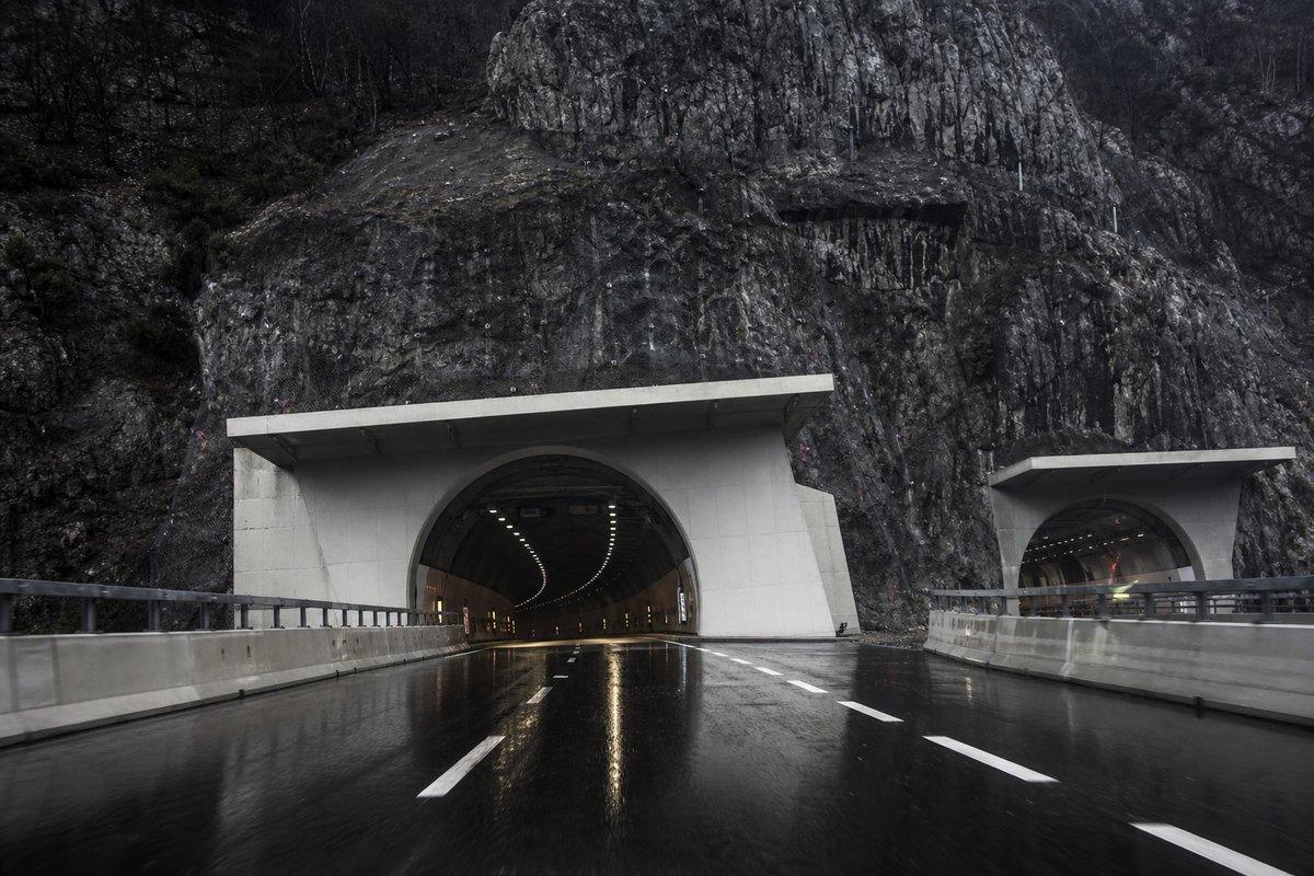
80 rows are rendered in total, so 23 of them carry a note or a blank where a length belongs and are shown without being counted. The middle half of the table runs from 0.2 km to 1.2 km, and that band is where most of the engineering on this page actually sits.
The median entry measures 0.53 km, so half the table sits below that and half above, which is a better guide to the typical structure here than the headline figure. The shortest recorded entry is 0.06 km against 7.93 km at the top, a spread of 132.08x across the same table.
The 62 entries are grouped on the page under 10 headings — exit tartano-talamona (p.k.19+287) (17), reg. lombardy – prov. so (11), exit sondalo (8), exit capitania – bormio (7) and exit lovero (4) — a classification the table carries as section breaks rather than as a column of its own.
- 57entries listed
- 7.93 kmlongest bore
- 60.42 kmtotal length
The record table
How this archive measures: lengths, bores, dates and ordering
| Tunnel / Viaduct | Length | Notes | — |
|---|---|---|---|
| Reg. Lombardy – Prov. SO | |||
| Trivio di Fuentes. Viaduct Rotatoria 3 ( 36 m ) on ramps - Connection S.S. 36 | |||
| Rotatoria 1 | 36 m | 36 m | |
| Rotatoria 2 | 36 m | 36 m | |
| Fuentes | 400 m | 400 m | |
| Borgofrancone | 106 m | 106 m | |
| Valtellina | 3 850 m | 3 850 m | |
| Exit Cosio (p.k. 9+300). Viaducts Adda- S.P. 58 ( 264 m ) and FS-S.S. 38 ( 320 m ) on ramps | |||
| Canale Orobia | 60 m | 60 m | |
| Adda-Bitto | 290 m | 235 m | |
| Selva Piana | 2 777 m | 2 846 m | |
| Cermoledo | 46 m | 25 m | |
| Paniga | 2 765 m | 2 765 m | |
| Adda-Talamona | 370 m | 370 m | |
| Exit Tartano-Talamona (p.k.19+287) | |||
| Sirta-Selvetta | 5 307 m | 5 275 m | |
| Tartano | 540 m | On actual S.S. 38 | |
| Modrasco | 793 m | 793 m | |
| San Rocco 1 | 289 m | 289 m | |
| Colorina | 604 m | 604 m | |
| San Rocco 2 | 163 m | 163 m | |
| San Rocco 3 | 541 m | 541 m | |
| Gherbiscione | 604 m | 604 m | |
| Cervio | 352 m | 352 m | |
| Adda 1 | 370 m | - | |
| Adda 1 | 260 m | 260 m | |
| San Colombano | 415 m | 415 m | |
| Caldenno | 163 m | 163 m | |
| Castione | 163 m | 163 m | |
| Vendolo | 730 m | 730 m | |
| Sassella | 730 m | 730 m | |
| Sondrio | 136 m | 136 m | |
| Exit Sondrio - Valchiavenna | |||
| Sassella | 306 m | Sondrio bypass | |
| Mallero | 98 m | ||
| Canale ENEL | 78 m | ||
| Exit Sondrio-Via Samaden | |||
| Exit Montagna | |||
| Montagna | 793 m | ||
| Ponte Canale | 19 m | ||
| Poggiridenti | 2 411 m | ||
| Exit Tresivio . Tunnel ( 209 m ) on ramp | |||
| -New Section in project- | |||
| Exit Stazzona - S.S. 550 . Viaduct Adda-Stazzona ( 336 m ) on ramp | |||
| Exit Tirano - S.S. 38 dir A - CH border. Viaduct Poschiavino 1 ( 47 m ) and tunnel Ramaione ( 1.572 m ) on ramp | |||
| Il Dosso | 2 044 m | ||
| Cologna | 1 998 m | ||
| S.Gottardo Artificiale | 916 m | ||
| Exit Lovero | |||
| Grosotto | 913 m | ||
| Grosio | 1 408 m | ||
| Tiolo | 528 m | ||
| Bolladore – (Valmaggiore) | 2 748 m | Two tunnels, linked by artificial part | |
| Exit Sondalo | |||
| Adda 1 | 300 m | ||
| Mondadizza | 1 494 m | ||
| Adda 2 | 102 m | ||
| Le Prese | 85 m | ||
| Le Prese | 983 m | ||
| Le Prese | 403 m | ||
| Verzedo | 2 376 m | ||
| Sant'Antonio Cepina | 7 925 m | Three tunnels: S. Antonio (2360 m) + Tola (1757 m)+ Cepina (3241 m) linked by 602 m artificial | |
| Exit Capitania – Bormio | |||
| Bagni Nuovi* | 30 m | ||
| ? | 200 m | ||
| Braulio I* | 200 m | ||
| Braulio II* | 170 m | ||
| Braulio III* | 100 m | ||
| Braulio IV* | 200 m | ||
| Braulio V* | 200 m | ||
| Passo dello Stelvio (2758 m) – Reg. Trentino Alto Adige - prov. BZ | |||
| Silandro | |||
| Stava | 970 m | ||
| Naturno | 2 376 m | ||
| Monte Benedetto (Kuchelberg) | 3 170 m | Under Merano | |
| Maia Bassa | 350 m | 350 m | River Adige. Section classified as "MeBo", Merano-Bolzano highway |
| Exit Appiano | |||
| Castel Firmiano | 946 m | 940 m | |
| Castel Firmiano | 850 m | 850 m | on River Adige - A22 motorway |
| Exit Bolzano – connection A22 Modena-Brenner |
How this table is compiled
2 of the 57 measured entries exceed five kilometres, and those are the ones that carry a full ventilation and escape regime. Laid end to end the entries on this page would run 60.42 km, which is a number with no engineering meaning but a useful sense of the scale of what is catalogued.
The table below lists 57 entries with a recorded length, each giving a name, a length in metres and, where documented, the year of opening. The tunnel / viaduct column names 56 distinct entries on this page, Rotatoria 1 and Rotatoria 2 among them, each traceable to the operator or administration record it was taken from.
This page records the structures catalogued along the SS38 in Italy, in a tunnel almanac maintained at this address since the late 1990s. The captions name 20 distinct places and structures — Adige, Fuentes and Rotatoria among them — and those names are the index into the length tables where each is recorded with its own figure.
The three longest entries alone account for 17.08 km of the 60.42 km on this page, which is 28 per cent of the total from 3 of 57 rows. The shorter half of the table totals 6.33 km against 54.09 km for the longer half, from the same number of rows.
Between the longest and the tenth-longest the drop is 5.55 km, which is the part of the table that changes when a single scheme opens. Where one of these 57 lengths disagrees with an operator's own figure for Italy, the table keeps the published value and notes the difference instead of averaging the two.
Reading the figures
Lengths for Italy are recorded in metres which is how the operators publish them and why the shortest entry here reads as 60 m and not a rounded figure. The longest entry is 132.1 times the shortest and 15.0 times the median, which is the quickest measure of how uneven the table is.
A new scheme in Italy would have to beat 7.93 km to change the head of this table, and that is the figure worth rechecking when one opens. The eighth longest is Poggiridenti at 2.41 km, which is about where this record stops being about record holders and starts being about ordinary infrastructure.
The note column places the route in Lombardy, Trentino, and the administrative area is recorded because a section is identified by it. The table on this page runs to 62 rows and records Tunnel / Viaduct, Length and Notes for each of them, which is the shape the original compiler chose rather than one imposed here.
The material on this page is held in 10 captions rather than in running text, 123 words of it, each written against the image or row it belongs to by the compiler who put the page together. The kilometre point is recorded for each structure on the SS38, which is how the operator identifies it.
They are not uniform: the fullest runs to 22 words and the briefest to 6, and on a page of this kind the long ones are where the explanation lives — the caption carries what the picture cannot. A crossing whose two carriageways differ in length is recorded once per direction rather than once per crossing.
Questions about Italy
What is the longest structure in Italy?
On the figures recorded here it is Sant'Antonio Cepina, at 7.93 km. It is the longest of the 57 entries recorded here, measured by bore length rather than span, cost or construction difficulty.
How many structures are listed for Italy?
57 entries with a recorded length appear on this page, from 0.06 km at the short end to 7.93 km at the top, with the middle of the set around 0.53 km. The table renders 80 rows in total; the rest carry a note or a blank where a length belongs.
What is a typical length among the structures listed for Italy?
The median entry measures 0.53 km and the middle half of the table runs from 0.2 km to 1.2 km. The headline figure of 7.93 km is the outlier, not the norm, which is why the median is the more useful number when comparing one national list against another.
How close is the top of the Italy table?
The longest stands 2.62 km clear of the next entry, and nothing else comes within ten per cent of it. A newly announced scheme therefore has to beat 7.93 km to displace Sant'Antonio Cepina.
What else does the SS38 table record besides structures?
The note column follows the route in running order and records 9 exits. The note column places the route in 1 province (SO). Junctions are listed at their kilometre point, which is how a section is identified in the field.
Other pages in this section
- Structures on the A1 var: the Variante di Valico, Bologna to Firenze
- Tunnels and Viaducts on the A01 Motorway in Italy, by Kilometre Point
- Tunnels and Viaducts on the A02 Motorway in Italy, by Kilometre Point
- Tunnels and Viaducts on the A03 Motorway in Italy, by Kilometre Point
- Tunnels and Viaducts on the A04 Motorway in Italy, by Kilometre Point
- Tunnels and Viaducts on the A05 Motorway in Italy, by Kilometre Point
- Tunnels and Viaducts on the A06 Motorway in Italy, by Kilometre Point
- Tunnels and Viaducts on the A07 Motorway in Italy, by Kilometre Point
- Tunnels and Viaducts on the A08 Motorway in Italy, by Kilometre Point
- Tunnels and Viaducts on the A09 Motorway in Italy, by Kilometre Point
- Tunnels and Viaducts on the A10 Motorway in Italy, by Kilometre Point
- Tunnels and Viaducts on the A11 Motorway in Italy, by Kilometre Point
- Tunnels and Viaducts on the A12 Motorway in Italy, by Kilometre Point
- Tunnels and Viaducts on the A13 Motorway in Italy, by Kilometre Point
- Tunnels and Viaducts on the A14 Motorway in Italy, by Kilometre Point
- Tunnels and Viaducts on the A15 Motorway in Italy, by Kilometre Point
- Tunnels and Viaducts on the A16 Motorway in Italy, by Kilometre Point
- Tunnels and Viaducts on the A18 Motorway in Italy, by Kilometre Point
- Tunnels and Viaducts on the A19 Motorway in Italy, by Kilometre Point
- Tunnels and Viaducts on the A20 Motorway in Italy, by Kilometre Point
- Tunnels and Viaducts on the A21 Motorway in Italy, by Kilometre Point
- Tunnels and Viaducts on the A22 Motorway in Italy, by Kilometre Point
- Tunnels and Viaducts on the A23 Motorway in Italy, by Kilometre Point
- Tunnels and Viaducts on the A24 Motorway in Italy, by Kilometre Point
- Tunnels and Viaducts on the A25 Motorway in Italy, by Kilometre Point
- Tunnels and Viaducts on the A26 Motorway in Italy, by Kilometre Point
- Tunnels and Viaducts on the A27 Motorway in Italy, by Kilometre Point
- Tunnels and Viaducts on the A28 Motorway in Italy, by Kilometre Point
- Tunnels and Viaducts on the A29 Motorway in Italy, by Kilometre Point
- Tunnels and Viaducts on the A30 Motorway in Italy, by Kilometre Point
- Tunnels and Viaducts on the A31 Motorway in Italy, by Kilometre Point
- Tunnels and Viaducts on the A32 Motorway in Italy, by Kilometre Point
- Tunnels and Viaducts on the A33 Motorway in Italy, by Kilometre Point
- Tunnels and Viaducts on the A34 Motorway in Italy, by Kilometre Point
- Tunnels and Viaducts on the A35 Motorway in Italy, by Kilometre Point
- Tunnels and Viaducts on the A36 Motorway in Italy, by Kilometre Point
- Tunnels and Viaducts on the A4-A31-A27 Motorway, by Kilometre Point
- Tunnels and Viaducts on the A50 Motorway in Italy, by Kilometre Point
- Tunnels and Viaducts on the A51 Motorway in Italy, by Kilometre Point
- Tunnels and Viaducts on the A52 Motorway in Italy, by Kilometre Point
- Tunnels and Viaducts on the A58 Motorway in Italy, by Kilometre Point
- Tunnels and Viaducts on the A90 Motorway in Italy, by Kilometre Point
- Tunnels and Viaducts on the D08 Motorway in Italy, by Kilometre Point
- Tunnels and Viaducts on the D11 Motorway in Italy, by Kilometre Point
- Tunnels and Viaducts on the D15 Motorway in Italy, by Kilometre Point
- Tunnels and Viaducts on the D29 Motorway in Italy, by Kilometre Point
- Tunnels and Viaducts on the D29A Motorway in Italy, by Kilometre Point
- Traforo del Monte Bianco: the Mont Blanc Tunnel Reopened in 2002
- Tunnels and Viaducts on the R03 Motorway in Italy, by Kilometre Point
- Tunnels and Viaducts on the R04 Motorway in Italy, by Kilometre Point
- Tunnels and Viaducts on the R30 Motorway in Italy, by Kilometre Point
- Tunnels and Viaducts on the R33 Motorway in Italy, by Kilometre Point
- Tunnels on the Italian State Roads SS 100 to SS 199, Listed by Route
- Tunnels and Viaducts on the S.S. 125 var, Cagliari to Tortoli
- Tunnels and Viaducts on the SS33 Motorway in Italy, by Kilometre Point
- Tunnels and Viaducts on the SS340 in Italy, by Kilometre Point
- Tunnels and Viaducts on the SS36 Motorway in Italy, by Kilometre Point
- Tunnels and Viaducts on the TEM — Tangenziale Esterna Est Milano
- Motorways' Chronology in Italy — Section Openings Listed by Date
- Motorways in Italy, Page 2 — Tunnels and Viaducts by Kilometre Point
- Motorways in Italy — the Numbering Scheme, Routes and Structures
- The Furlo Tunnel in Italy: Portals, Photographs and Setting
- Road Tunnels in Italy — Complete List by Length, Part 1000
- Road Tunnels in Italy — Complete List by Length, Part 750
- Road Tunnels in Italy — Complete List by Length
Cite this page
Tunnels and Viaducts on the SS38 Motorway in Italy, by Kilometre Point. The World's Longest Tunnels. https://www.lotsberg.net/data/italia/SS38.html
Related record tables
- Structures on the A1 var, Variante di Valico, Italy
- Tunnels and Viaducts on the A01 Motorway in Italy
- Tunnels and Viaducts on the A02 Motorway in Italy
- Tunnels and Viaducts on the A03 Motorway in Italy
- Tunnels and Viaducts on the A04 Motorway in Italy
- Tunnels and Viaducts on the A05 Motorway in Italy
- Tunnels and Viaducts on the A06 Motorway in Italy
- Tunnels and Viaducts on the A07 Motorway in Italy
- Tunnels and Viaducts on the A08 Motorway in Italy
- Tunnels and Viaducts on the A09 Motorway in Italy
- Tunnels and Viaducts on the A10 Motorway in Italy
- Tunnels and Viaducts on the A11 Motorway in Italy