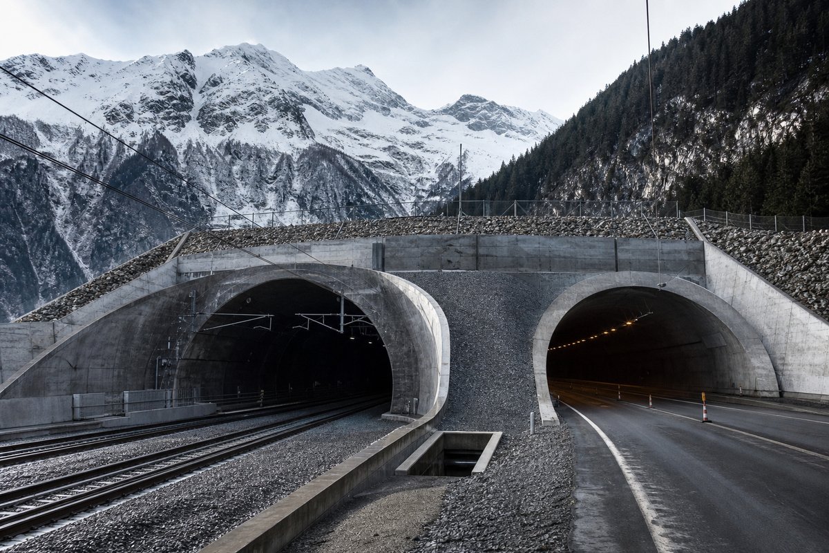
The ordering is by the longer of the two records in each country, which keeps the countries with a single strong entry visible. Length is the dimension published most consistently across borders, which is why it governs the ordering, but it is a poor measure of difficulty. Opening year means the year traffic was admitted.
A base tunnel trades much greater length for a far lower summit altitude, which is why the Alpine countries dominate the rail column. Only structures open to traffic can hold a record. Structures below the reporting threshold of the responsible administration do not appear, which is why short galleries are absent from most national lists.
A continent is not a meaningful engineering unit, but it is how the question is asked, so it is worth answering precisely. Published lengths for the same structure often differ by a few metres between sources, depending on whether the cut-and-cover approach is counted. The note column is worth reading before the number.
- 30entries listed
The record table
Every Europe country in this archive with a recorded tunnel, longest first. Structures not yet open to traffic are excluded, so a country's entry can be shorter than its best-known project.
How this archive measures: lengths, bores, dates and ordering
| Country | Longest road tunnel | Opened | Longest railway tunnel | Inventory |
|---|---|---|---|---|
| Switzerland | St. Gotthard 16.94 km | 1980 | Gotthard Base 57.07 km | All entries |
| the United Kingdom | Mersey Queensway 3.24 km | 1934 | Channel tunnel 50.45 km | All entries |
| France | Mont Blanc / Monte Bianco 11.61 km | 1965 | Chunnel 50.45 km | All entries |
| Norway | Laerdal 24.51 km | 2000 | Romeriksporten 14.58 km | All entries |
| Austria | Arlberg 15.52 km | 1978 | All entries | |
| Türkiye | Mount Ovit 14.7 km | All entries | ||
| Finland | Savio 13.5 km | All entries | ||
| Italy | Frejus 12.9 km | 1980 | All entries | |
| Faroe Islands | Sandöyar 12 km | All entries | ||
| Iceland | Dynjandisheiði 10.8 km | 2020 | All entries | |
| Spain | Somport 8.61 km | 2003 | All entries | |
| Slovenia | Karavanke 8.02 km | 1991 | All entries | |
| Germany | Rennsteig 7.92 km | 2003 | All entries | |
| Slovakia | Visnové 7.46 km | 2012 | All entries | |
| the Netherlands | Westerschelde 7.03 km | All entries | ||
| Czechia | Blanka 6.38 km | 2015 | All entries | |
| Greece | Tempi 5.96 km | All entries | ||
| Portugal | Marão 5.83 km | 2016 | All entries | |
| Croatia | Mala Kapela 5.82 km | 2005 | All entries | |
| Ireland | Dublin Port 4.5 km | 2006 | All entries | |
| Sweden | Lovön 4.5 km | 2018 | All entries | |
| Russia | Gimrinsky 4.3 km | All entries | ||
| Georgia | Roki 3.66 km | 1985 | All entries | |
| Denmark | Drogden 3.52 km | 2000 | All entries | |
| Luxembourg | Grouft 2.97 km | 2013 | All entries | |
| Bosnia and Herzegovina | Vijenac / 1 Mart 2.94 km | 2014 | All entries | |
| Andorra | Dos Valires 2.92 km | 2012 | All entries | |
| Belgium | Leopold III -Sainctelette 2.53 km | 1977 | All entries | |
| Serbia | Dedinje 2.07 km | 2009 | All entries | |
| Poland | Wislostrada 0.93 km | 2003 | All entries |
How this table is compiled
Reading down the table shows how unevenly tunnelling is distributed even within one continent. A record of this kind moves whenever one scheme opens, and a page that is not re-checked drifts out of date silently. Corrections have historically arrived by letter rather than by form, and that is still how most errors in it have been found.
Geology and settlement pattern shape a national list far more than transport policy does. Where a country has been redrawn administratively since an entry was recorded, the region code reflects the classification then in use. The same journey time can be bought with one long bore in one country and a dozen short ones in another.
Switzerland heads this table, with St. Gotthard 16.94 km as its longest recorded structure. Terrain explains most of that unevenness: a country with mountains and fjords will out-tunnel a flat neighbour many times over. Twin-tube crossings frequently carry two slightly different lengths, because the two carriageways rarely follow the same line through the rock.
Funding practice explains the rest, because tunnels arrive in waves once a network plan is approved. Nothing on this page is estimated: a value that could not be corroborated is left blank rather than filled in. Country inventories in this archive are deeper than the summary row suggests, often running to a hundred entries or more.
Comparing a national list against a neighbour's is more informative than reading either alone. Cross-border tunnels are recorded under both countries, so the Channel Tunnel appears for France and for the United Kingdom alike. Opening dates refer to the admission of traffic rather than to breakthrough, which normally falls a year or two earlier.
Reading the figures
The table covers 30 countries, each linking through to an inventory that usually runs far deeper than one row. Continental rollups are the view this archive has never published, and they are derived from the same per-country inventories. Gradient limits are the main reason a country's longest railway tunnel usually exceeds its longest road tunnel.
Ventilation shafts allow a longer bore to be driven, and their absence is often what caps a national record. Toll arrangements and traffic figures are excluded throughout, because both change far faster than the structures do. This archive has held per-country tunnel inventories since the late 1990s, and this page is the aggregation across them.
Subaqueous tunnels are governed by rock cover above the bore rather than by the depth of water above that. Figures are compiled from operator publications, national administrations and the engineering press, and checked against one another. Where a country's best-known project is still under construction, its entry here is the longest structure actually carrying traffic.
Cross-border tunnels appear under both countries. Metres and kilometres follow the source publication. Length is measured portal to portal. Every figure is traceable to a named source. Rail figures follow the track centre line. Two sources were required for every figure. Names follow the operator's own spelling. A country's entry links to its full inventory.
Questions about this record
How is the ordering decided?
By the longer of a country's two records, road or rail. That keeps a country with one outstanding structure visible rather than burying it behind countries with two moderate ones.
Why are some countries missing a column?
Because they have no tunnel of that class on record. Many countries in this archive have road tunnels but no railway tunnels at all, and the blank is real rather than a gap in the compilation.
How is this page sourced?
From the per-country inventories in this archive, which are compiled from operator publications, national road and rail administrations and the engineering press. Structures not open to traffic are excluded from every record claim.
Why is a country missing from this table?
Because this archive holds no inventory for it that meets the standard used here. Absence means the compilation has nothing corroborated to show, not that the country has no tunnels, and a country is added when a sourced inventory exists rather than estimated in the meantime.
Other pages in this section
Cite this page
The longest tunnels in Europe: the road and railway record by country. The World's Longest Tunnels. https://www.lotsberg.net/tunnels/europe.html