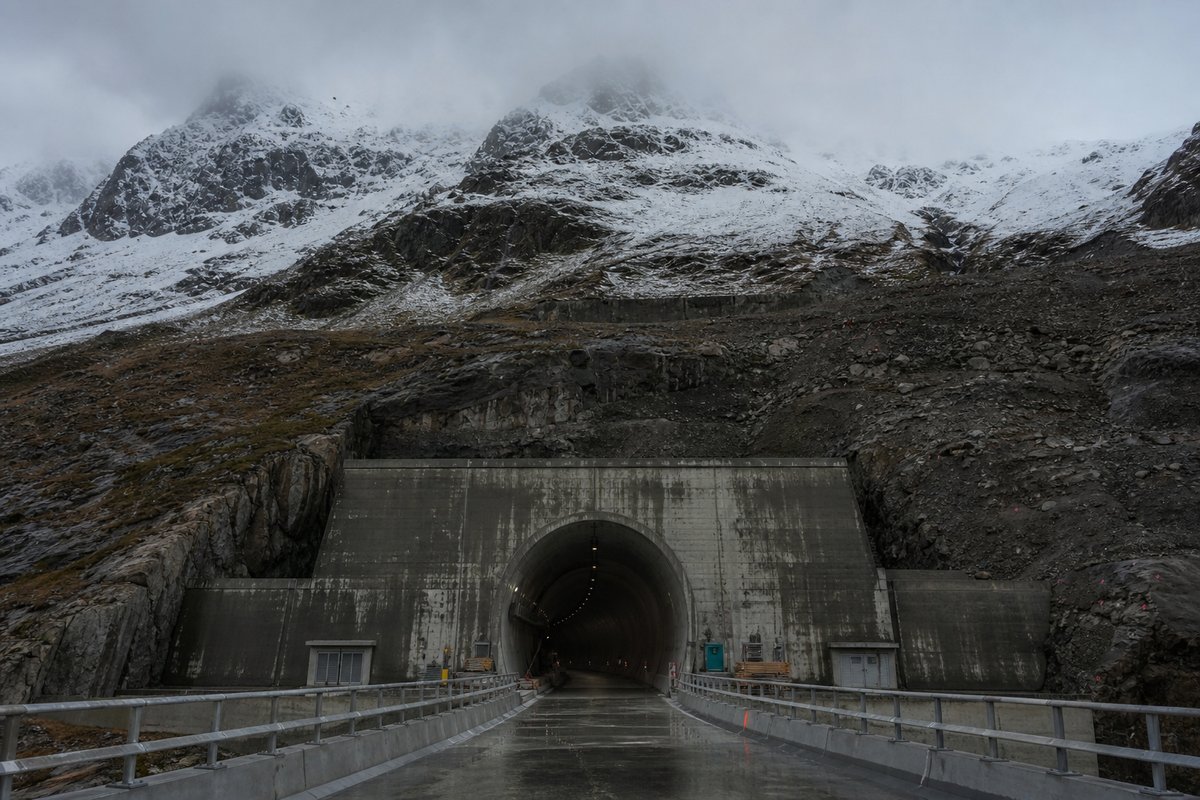
58 rows are rendered in total, so 25 of them carry a note or a blank where a length belongs and are shown without being counted. The middle half of the table runs from 0.02 km to 0.16 km, and that band is where most of the engineering on this page actually sits.
This page records the structures catalogued for Switzerland in a tunnel almanac maintained at this address since the late 1990s. Charnadura II at 0.69 km and Lunga at 0.63 km follow it, and lengths are given per carriageway because the two bores of a dual route are rarely cut to the same length.
The route table lists 33 structures with a recorded length, giving both carriageways where the two bores differ. The table on this page runs to 58 rows and records Tunnel / Viaduct, Lenght (m), Altitude (m), Note and km for each of them, which is the shape the original compiler chose rather than one imposed here.
- 33entries listed
- 0.84 kmlongest bore
- 4.73 kmtotal length
The record table
How this archive measures: lengths, bores, dates and ordering
| Tunnel / Viaduct | Lenght (m) | Altitude (m) | Note | km |
|---|---|---|---|---|
| 1 775 | St. Moritz Station | 61.6 | ||
| Inn | 64 | 1 774 | 61.8 | |
| Charnadura II | 689 | 1 766 | 62.1 | |
| 1 716 | Celerina Station | 63.6 | ||
| 1 736 | Punt Muragl Station | 65.1 | ||
| 1 772 | Pontresina Station | 67.4 | ||
| Ova da Roseg | 32 | 1 785 | 67.9 | |
| 1 822 | Surovas Station | 68.8 | ||
| 1 896 | Morterasch Station | 73.8 | ||
| Ova da Morterasch | 23 | 1 896 | 73.9 | |
| Ova da Bernina I | 28 | 1 914 | 74.0 | |
| Ova da Bernina II | 28 | 2 044 | Max. height: 14 m | 77.1 |
| 2 046 | Bernina Suot Station | 77.3 | ||
| 2 082 | Bernina Diavolezza Station | 78.4 | ||
| Ova da Bernina III | 10 | 2 080 | 78.5 | |
| 2 099 | Bernina Lagalb Station | 79.5 | ||
| Ova da Minor | 16 | |||
| Untere Berninabach | 37 | 2 120 | Max. height: 15 m | 80.1 |
| Ova da Arlas | 13 | |||
| Obere Berninabach | 31 | 2 167 | 81.3 | |
| Arlas | 175 | 2 212 | 81.5 | |
| Grenzbach | 4 | |||
| 2 253 | Ospizio Bernina Station | 83.9 | ||
| Ponte sul Lago / Am See | 46 | 2 241 | 84.5 | |
| Scala Art. | 140 | 2 234 | 86.1 | |
| Lunga | 631 | 2 185 | Sassal Mason I Art.(16 m) + Scala (192 m)+ Sassal Mason II Art.(348 m) + Drago (54 m)+ Sassal Mason III Art.(20 m) linked tunnels | 87.0 |
| Grum | 264 | 2 100 | 88.3 | |
| 2 091 | Alp Grum Station | 88.6 | ||
| Palù | 840 | 2 049 | Artificial parts: Palù Sopra (239 m) + Palù Sotto (347 m) | 89.2 |
| Stablini | 333 | 1 966 | Artificial parts: Stablini I (28 m) + Stablini II (16 m) | 90.5 |
| 1 934 | Stablini Station | 91.1 | ||
| Pila I (Sopra) | 213 | 1 900 | 91.5 | |
| Val da Pila | 227 | 1 880 | 91.7 | |
| Pila II (Sotto) | 125 | 1 872 | 91.9 | |
| Val da Pila | 51 | 1 778 | Max. height: 22 m | 93.3 |
| 1 692 | Cavaglia Station | 94.7 | ||
| Cavagliasch | 10 | 1 682 | 95.3 | |
| Puntalto | 10 | 1 673 | 95.5 | |
| Val Veruna I | 149 | 1 530 | 97.4 | |
| 1 382 | Cadera Station | 99.8 | ||
| Val Veruna II | 147 | 1 346 | 100.3 | |
| Cavagliasco Sopra | 56 | 1 242 | Max. height: 25 m | 101.9 |
| Balbalera | 122 | 1 231 | 102.1 | |
| Cavagliasco Sotto | 43 | 1 212 | Max. height: 25 m | 102.3 |
| 1 119 | Privilasco Station | 103.6 | ||
| Val Varuna | 22 | 1 093 | 104.0 | |
| 1 014 | Poschiavo Station | 105.2 | ||
| 998 | Li Curt Station | 106.9 | ||
| 965 | Le Prese Station | 109.6 | ||
| 965 | Miralago Station | 112.4 | ||
| Poschiavino | 23 | 965 | 112.7 | |
| 780 | Brusio Station | 115.5 | ||
| Brusio | 116 | 717 | Max. height: 15 m | 116.4 |
| 637 | Campascio Station | 117.8 | ||
| Poschiavino | 14 | |||
| 553 | Campocologno Station | 119.2 | ||
| 530 | CH-I Border | 119.7 | ||
| 429 | Tirano Station | 122.3 |
How this table is compiled
The next two longest are Charnadura II at 0.69 km and Lunga at 0.63 km. Read down the altitude (m) column, the 54 values run from 429 m to 2 253 m with a midpoint at 1 774 m; the spread rather than the maximum is what says how uneven this set is.
Also recorded here are Grum at 0.26 km and Val da Pila at 0.23 km. Read down the km column, the 54 values run from 61.6 km to 122.3 km with a midpoint at 90.8 km; the spread rather than the maximum is what says how uneven this set is.
The median entry measures 0.05 km, so half the table sits below that and half above, which is a better guide to the typical structure here than the headline figure. The shorter half of the table totals 0.39 km against 4.34 km for the longer half, from the same number of rows.
The shortest recorded entry is 0.01 km against 0.84 km at the top, a spread of 84x across the same table. Only 34 of the 58 rows carry anything in the tunnel / viaduct column, so that field describes a minority of this table and the rest of the rows are recorded without it.
The longest stands 0.15 km clear of the next longest, which is the margin to watch when a new scheme is announced. Only 34 of the 58 rows carry anything in the lenght (m) column, so that field describes a minority of this table and the rest of the rows are recorded without it.
Reading the figures
16 entries sit above the median and 17 at or below it, so the table is top-heavy and not clustered at one end. The captions name 8 distinct places and structures — Mason, Sassal and Palù among them — and those names are the index into the length tables where each is recorded with its own figure.
Between the longest and the tenth-longest the drop is 0.69 km, which is the part of the table that changes when a single scheme opens. Where one of these 33 lengths disagrees with an operator's own figure for Switzerland, the table keeps the published value and notes the difference instead of averaging the two.
Lengths for Switzerland are recorded in metres which is how the operators publish them and why the shortest entry here reads as 10 m and not a rounded figure. The longest entry is 84.0 times the shortest and 16.5 times the median, which is the quickest measure of how uneven the table is.
A new scheme in Switzerland would have to beat 0.84 km to change the head of this table, and that is the figure worth rechecking when one opens. The eighth longest is Arlas at 0.18 km, which is about where this record stops being about record holders and starts being about ordinary infrastructure.
The entries sum to roughly 4.73 km of bore, an average of about 0.14 km each, though that average describes no actual row. The three longest entries alone account for 2.16 km of the 4.73 km on this page, which is 46 per cent of the total from 3 of 33 rows.
Questions about Switzerland
What is the longest structure in Switzerland?
On the figures recorded here it is Palù, at 0.84 km. It is the longest of the 33 entries recorded here, measured by bore length rather than span, cost or construction difficulty.
How many structures are listed for Switzerland?
33 entries with a recorded length appear on this page, from 0.01 km at the short end to 0.84 km at the top, with the middle of the set around 0.05 km. The table renders 58 rows in total; the rest carry a note or a blank where a length belongs.
What is a typical length among the structures listed for Switzerland?
The median entry measures 0.05 km and the middle half of the table runs from 0.02 km to 0.16 km. The headline figure of 0.84 km is the outlier, not the norm, which is why the median is the more useful number when comparing one national list against another.
How close is the top of the Switzerland table?
The longest stands 0.15 km clear of the next entry, and nothing else comes within ten per cent of it. A newly announced scheme therefore has to beat 0.84 km to displace Palù.
How many structures does this route carry?
33 named tunnels and viaducts have a recorded length on this route, the longest being Palù at 0.84 km, followed by Charnadura II at 0.69 km and Lunga at 0.63 km; 30 of the 33 are under 500 metres.
Other pages in this section
- Structures on the A1 in Switzerland, Geneva to St. Margrethen
- Tunnels and Viaducts on the A3 in Switzerland, Basel to Sargans
- Road Tunnels in Switzerland — Complete List by Length, Part 000
- Road Tunnels in Switzerland — Complete List by Length, Part 1000
- Road Tunnels in Switzerland — Complete List by Length
- Railway Tunnels in Switzerland — Complete List by Length
- Railway Tunnels in Switzerland — 42 Listed by Length
Cite this page
Structures on the Rhaetian Railway Bernina Line, St. Moritz to Tirano. The World's Longest Tunnels. https://www.lotsberg.net/data/sveits/RHB-Bernina.html
Related record tables
- BART Tunnels and Tubes in the San Francisco Bay Area
- The Salang Tunnel in Afghanistan: Road and Galleries
- The Perisher Blue Skitube: a Rack Railway in Australia
- Tunnels and Viaducts on the A8 Motorway in France
- Tunnels and Viaducts on the A43 Motorway in France
- Structures on the A51 Motorway in France
- Der Alte Elbtunnel: the Old Elbe Tunnel in Hamburg
- The Mont Blanc Tunnel on the Day of Reopening, 2002
- Structures on the SS 125 var in Sardinia, Italy
- The Furlo Tunnel in Italy: Portals and Photographs
- Aqueduct and Water Conveyance Tunnels in Japan
- Hydropower and Headrace Tunnels in Nepal