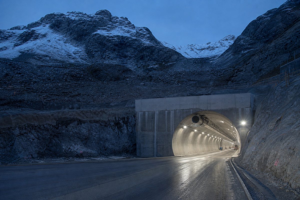
150 rows are rendered in total, so 106 of them carry a note or a blank where a length belongs and are shown without being counted. The middle half of the table runs from 0.4 km to 1.21 km, and that band is where most of the engineering on this page actually sits.
The median entry measures 0.55 km, so half the table sits below that and half above, which is a better guide to the typical structure here than the headline figure. The shortest recorded entry is 0.11 km against 3.23 km at the top, a spread of 28.84x across the same table.
32 entries fall below a kilometre, short enough that portals and approaches usually decided their cost more than the bore itself. Pomy at 3.01 km and Arrisoules at 2.99 km follow it, and lengths are given per carriageway because the two bores of a dual route are rarely cut to the same length.
- 44entries listed
- 3.23 kmlongest bore
- 39.06 kmtotal length
The record table
How this archive measures: lengths, bores, dates and ordering
| Tunnel / Viaduct | Length (m) Direction St.Margrethen | Length (m) Direction Geneve | Notes |
|---|---|---|---|
| France border. Connection A401 - Canton GE | |||
| Connection 1"Perly" - A1a Geneve Carouge | |||
| Exit 2 Perly | |||
| Aire | ? | ? | |
| Confignon | 1 240 m | 1 240 m | |
| Exit 3 Berneux | |||
| TC des Chevres | 400 m | 400 m | |
| Rhone | ? | ? | |
| Vernier | 1 940 m | 1 860 m | |
| Exit 4 Geneve Vernier | |||
| Exit 5 Geneve Meyrin | |||
| Exit 6 Airport Geneve-Cointrin | |||
| Exit 7 Airport Geneve - Fernay | |||
| Exit 8 Versoix | |||
| Connection 9 "Le Vengeron" - A1a Lac | |||
| Versoix | 304 m | 304 m | |
| Exit 10 Coppet | |||
| Exit 11 Nyon - Canton VD | |||
| Orbe | 2 080 m | 2 080 m | |
| Exit 12 Gland | |||
| Service Areas "La Cote" | |||
| Exit 13 Rolle | |||
| Exit 14 Aubonne | |||
| Exit 15 Morges Ouest | |||
| Exit 16 Morges Est | |||
| Connection 17 "Ecublens" - A1LS Lausanne Ecublens | |||
| Exit 18 Lausanne Crissier | |||
| Connection 19 "Villars S.te Croix" - A9 Brig | |||
| Exit 20 Cossonay | |||
| Exit 21 La Sarraz | |||
| Shell | Shell | Service Areas "Bavois" | |
| Coudray | 496 m | 484 m | |
| Exit 22 Chavornay | |||
| Connection 23 "Essert Pittet" - A9 Ballaigues / France | |||
| Connection 24 "Yverdon" - A5 Solothurn | |||
| Exit 25 "Yverdon Sud" | |||
| ? | 200 m | 200 m | |
| Pomy | 3 005 m | 2 958 m | |
| Champ Baly | 240 m | 240 m | |
| Cuarny | 420 m | 420 m | |
| Cronay | 929 m | 929 m | |
| Mentue | 540 m | 540 m | |
| Vaux | 945 m | 945 m | |
| Golaz | 384 m | 450 m | |
| Arrisoules | 2 987 m | 2 987 m | Canton VD-FR |
| Baume | 190 m | 190 m | |
| Bruyeres-Chables | 1 860 m | 1 840 m | |
| Passage Faune Chevrefu | 112 m | 112 m | |
| Lully | 958 m | 958 m | |
| TC Frasses | 466 m | 466 m | Exit 26 Estavayer Le Lac - Service Area "Rose de la Broye" ( BP ) over the TC |
| TC Sevaz | 540 m | 527 m | |
| Exit 27 Payerne | |||
| Broye | 468 m | 468 m | |
| Exit 28 Avanches | |||
| Bois de Rossette | 617 m | 617 m | |
| Les Vignes | 2 300 m | 2 100 m | FR-BE |
| Chantemerle - TC Combette | 1 373 m | 1 123 m | (Tunnel Chantemerle only dir. St.Margrethen) |
| Lowenberg | 665 m | 665 m | Exit 29 Murten - Neuchatel |
| Galmiz | 729 m | 729 m | |
| Exit 30 Kerzers - T10 | |||
| Saane | 849 m | 849 m | |
| Exit 31 Muhleberg | |||
| Exit 32 Bern Brunnen | |||
| TC Brunnen | 550 m | 550 m | |
| Exit 33 Bern Bethlehem | |||
| Connection 34 "Weyermannshaus" - A12 Vevey | |||
| Exit 35 Bern Forsthaus | |||
| Exit 36 Bern Neufeld | |||
| Felsenau (Aar) | 1 116 m | 1 116 m | |
| Connection 37 "Wankdorf" - A6 Thun | |||
| Esso | Tamoil | Service Areas "Grauholz" | |
| Connection 38 "Schonbuhl" - T6 Biel | |||
| Exit 39 Kirchberg | |||
| Emme | ? | ? | |
| Exit 40 Kriegstetten | |||
| Connection 41 "Luterbach" - A5 Neuchatel | |||
| BP | Agip | Service Areas "Deitingen" | |
| Aar | 200 m | 200 m | |
| Exit 42 Wangen | |||
| Exit 43 Niederbipp | |||
| Exit 44 Oensingen | |||
| Connection 45 "Harkingen" - A2 Basel - Start section in common with A2 | |||
| / | Migrol | Service Area "Gunzgen Nord" | |
| BP | / | Service Area "Gunzgen Sud" | |
| Aar | 235 m | 235 m | Canton BE-AG |
| Aar | 145 m | 145 m | |
| Exit 46 Rothrist | |||
| Connection 47 "Wiggertal" - A2 Chiasso - End section in common with A2 | |||
| Exit 48 Oftringen | |||
| Service Areas Kolliken | |||
| Exit 49 Aarau West | |||
| Exit 50 Aarau Ost | |||
| Exit 51 Lenzburg | |||
| Exit 52 Magenwil | |||
| Connection 53 "Birrfeld" - A3 Basel | |||
| Exit 54 Baden | |||
| Baregg | 1 390 m | 1 390 m | Third tube: 1 148 m |
| Exit 55 Neuenhof | |||
| Neuenhof | 0 m | / | |
| Limmat | ? | ? | |
| Exit 56 Wettingen | |||
| Limmat | ? | ? | |
| Shell | Shell | Service Areas "Wurenlos" | |
| Exit 57 Spreitenbach | |||
| Exit 58 Dietikon - Canton ZH | |||
| Connection 59 "Limmattal" - A4 Zurich West Ring | |||
| Exit 60 Weiningen | |||
| Gubrist | 3 230 m | 3 230 m | |
| Exit 61 Zurich Affoltern | |||
| Exit 62 Zurich Seebach | |||
| Stelzen | 375 m | 375 m | |
| Connection 63 "Zurich Nord" - A51 Bulach | |||
| Connection 64 "Zurich Ost" - Zurich Centre | |||
| Exit 65 Wallisellen | |||
| Exit 66 Bruttisellen / Connection "Bruttisellen" - A53 Rapperswil | |||
| Exit 67 Effretikon | |||
| BP | BP | Service Areas "Kempthal" | |
| Toss | 400 m | 400 m | |
| Exit 68 Winterthur Toss | |||
| Toss | 160 m | 160 m | |
| Exit 69 Winterthur Wulfingen | |||
| Connection 70 "Winterthur Nord" - A4 Schaffhausen | |||
| Exit 71 Winterthur Ohringen | |||
| Avia | Esso | Service Areas "Forrenberg" | |
| Exit 72 Oberwinterthur | |||
| Connection 73 "Winterthur Ost" - A7 Kreuzlingen / D border | |||
| / | Exit 74 Attikon | ||
| Canton AG-TG | |||
| Exit 75 Matzingen | |||
| Exit 76 Munchwilen | |||
| Exit 76b Wil West | |||
| Canton TH-SG | |||
| Exit 77 Wil | |||
| Thur | 505 m | 505 m | |
| BP | BP | Service Areas "Thurau" | |
| Exit 78 Uzwil | |||
| Exit 79 Gossau | |||
| Exit 80 St.Gallen Winkeln | |||
| Sitter | 600 m | 600 m | |
| Sitterwald | 395 m | 395 m | |
| Exit 81 St.Gallen Kreuzbleiche / Appenzell. Tunnel Schoren (1100-800 m) on ramps | |||
| Rosenberg | 1 435 m | 1 435 m | |
| Exit 82 St.Gallen-St.Fiden | |||
| Stephanshorn | 570 m | 570 m | |
| Exit 83 St.Gallen Neudorf | |||
| ? | 450 m | 450 m | |
| Connection 84 "Meggenhus" - A1.1 Arbon | |||
| Agip | Agip | Service Areas "St.Margrethen" | |
| Exit 86 St.Margrethen-Bregenz | |||
| Connection – A13 Bellinzona | |||
| TOTAL tunnels |
How this table is compiled
The route table lists 44 structures with a recorded length, giving both carriageways where the two bores differ. The material on this page is held in 18 captions rather than in running text, 140 words of it, each written against the image or row it belongs to by the compiler who put the page together.
Also recorded here are Orbe at 2.08 km and Vernier at 1.94 km. A tunnel list for Switzerland reads differently from a neighbouring country's: 2 of these 44 structures pass three kilometres, and the same journey time is bought with one long bore in one country and a dozen short ones in another.
The longest stands 0.23 km clear of the next longest, which is the margin to watch when a new scheme is announced. The captions name 46 distinct places and structures — Zurich, Ecublens and Nord among them — and those names are the index into the length tables where each is recorded with its own figure.
The three longest entries alone account for 9.22 km of the 39.06 km on this page, which is 24 per cent of the total from 3 of 44 rows. 22 entries sit above the median and 22 at or below it, so the table is evenly weighted and not clustered at one end.
Between the longest and the tenth-longest the drop is 1.86 km, which is the part of the table that changes when a single scheme opens. Where one of these 44 lengths disagrees with an operator's own figure for Switzerland, the table keeps the published value and notes the difference instead of averaging the two.
Reading the figures
Lengths for Switzerland are recorded in metres which is how the operators publish them and why the shortest entry here reads as 112 m and not a rounded figure. The longest entry is 28.8 times the shortest and 5.9 times the median, which is the quickest measure of how uneven the table is.
A new scheme in Switzerland would have to beat 3.23 km to change the head of this table, and that is the figure worth rechecking when one opens. The eighth longest is Rosenberg at 1.44 km, which is about where this record stops being about record holders and starts being about ordinary infrastructure.
Laid end to end the entries on this page would run 39.06 km, which is a number with no engineering meaning but a useful sense of the scale of what is catalogued. A canal tunnel is sized by the boat, not by the traffic, which is why the oldest of them are so narrow.
The entries sum to roughly 39.06 km of bore, an average of about 0.89 km each, though that average describes no actual row. On 8 of the structures here the two carriageways are not the same length, which is why the archive records each direction separately rather than one figure per crossing.
The ten longest average 2.16 km against 0.51 km for everything below them, and that ratio is the clearest thing this table says about the distribution. 19 of them are under 500 metres, which on a route of this kind usually means a cut-and-cover section or a short spur and not a driven bore.
Questions about Switzerland
What is the longest structure in Switzerland?
On the figures recorded here it is Gubrist, at 3.23 km. It is the longest of the 44 entries recorded here, measured by bore length rather than span, cost or construction difficulty.
How many structures are listed for Switzerland?
44 entries with a recorded length appear on this page, from 0.11 km at the short end to 3.23 km at the top, with the middle of the set around 0.55 km. The table renders 150 rows in total; the rest carry a note or a blank where a length belongs.
What is a typical length among the structures listed for Switzerland?
The median entry measures 0.55 km and the middle half of the table runs from 0.4 km to 1.21 km. The headline figure of 3.23 km is the outlier, not the norm, which is why the median is the more useful number when comparing one national list against another.
How close is the top of the Switzerland table?
The longest stands 0.23 km clear of the next entry, and 3 entries sit within ten per cent of it. A newly announced scheme therefore has to beat 3.23 km to displace Gubrist.
How many structures does this route carry?
44 named tunnels and viaducts have a recorded length on this route, the longest being Gubrist at 3.23 km, followed by Pomy at 3.01 km and Arrisoules at 2.99 km; 19 of the 44 are under 500 metres.
Other pages in this section
- Tunnels and Viaducts on the A3 in Switzerland, Basel to Sargans
- Structures on the Rhaetian Railway Bernina Line, St. Moritz to Tirano
- Road Tunnels in Switzerland — Complete List by Length, Part 000
- Road Tunnels in Switzerland — Complete List by Length, Part 1000
- Road Tunnels in Switzerland — Complete List by Length
- Railway Tunnels in Switzerland — Complete List by Length
- Railway Tunnels in Switzerland — 42 Listed by Length
Cite this page
Structures on the A1 in Switzerland, Geneva to St. Margrethen. The World's Longest Tunnels. https://www.lotsberg.net/data/sveits/A01CH.html
Related record tables
- BART Tunnels and Tubes in the San Francisco Bay Area
- The Salang Tunnel in Afghanistan: Road and Galleries
- The Perisher Blue Skitube: a Rack Railway in Australia
- Tunnels and Viaducts on the A8 Motorway in France
- Tunnels and Viaducts on the A43 Motorway in France
- Structures on the A51 Motorway in France
- Der Alte Elbtunnel: the Old Elbe Tunnel in Hamburg
- The Mont Blanc Tunnel on the Day of Reopening, 2002
- Structures on the SS 125 var in Sardinia, Italy
- The Furlo Tunnel in Italy: Portals and Photographs
- Aqueduct and Water Conveyance Tunnels in Japan
- Hydropower and Headrace Tunnels in Nepal