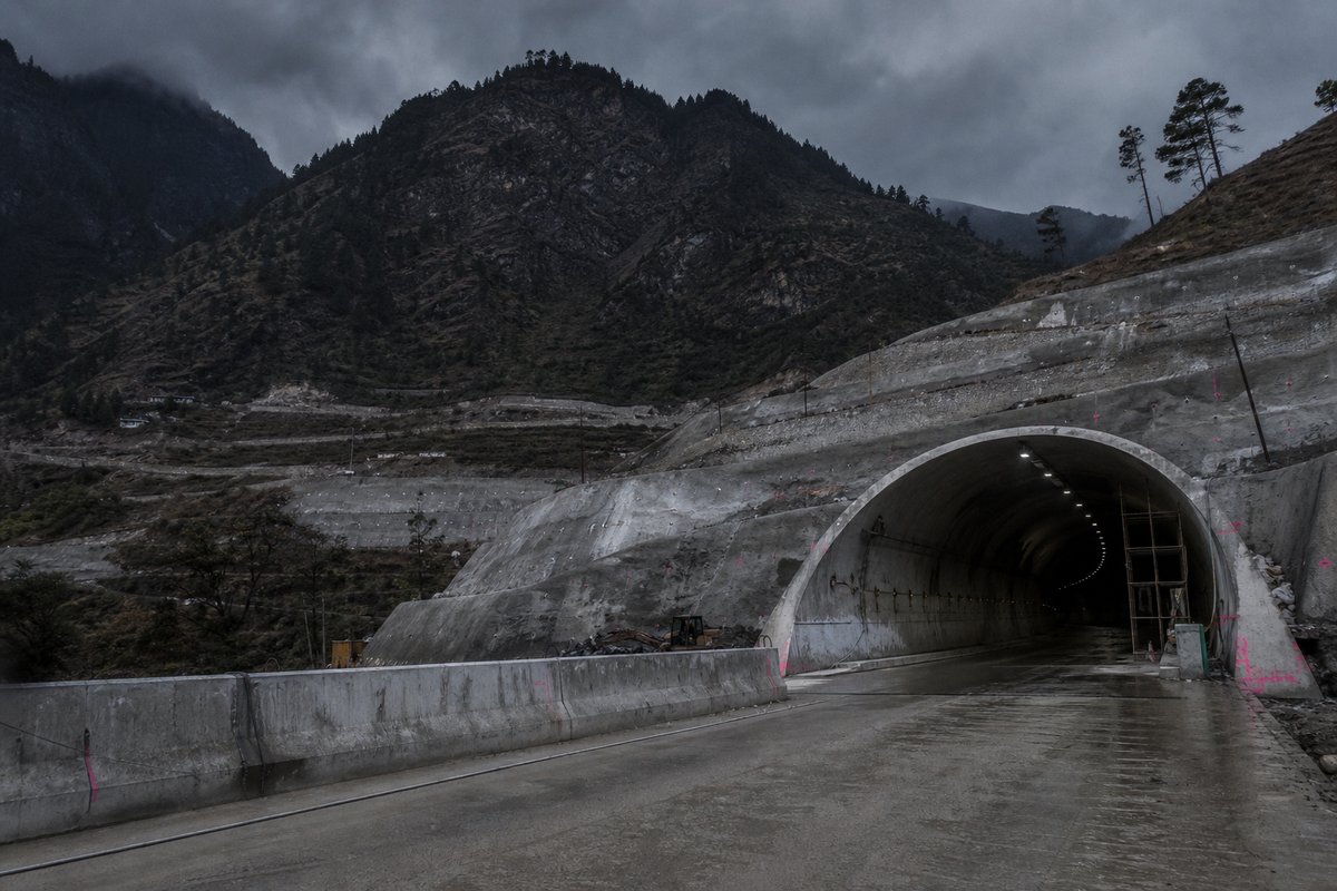
13 rows are rendered in total, so 1 of them carry a note or a blank where a length belongs and are shown without being counted. The middle half of the table runs from 0.5 km to 4.54 km, and that band is where most of the engineering on this page actually sits.
The median entry measures 1.84 km, so half the table sits below that and half above, which is a better guide to the typical structure here than the headline figure. The shortest recorded entry is 0.33 km against 9.02 km at the top, a spread of 27.33x across the same table.
The three longest entries alone account for 18.1 km of the 25.43 km on this page, which is 71 per cent of the total from 3 of 9 rows. After the 2000s the next busiest decade here is the 1960s with 1 openings, so the building effort came in more than one wave.
- 12entries listed
- 9.02 kmlongest bore
- 1961–2020openings span
- 25.43 kmtotal length
The record table
Figures on this page were last checked against operator and administration sources on 2 September 2026.
How this archive measures: lengths, bores, dates and ordering
| Tunnel | Length | Date of opening | State | Notes | Road |
|---|---|---|---|---|---|
| Atal (Rohtang) | 9 020 m | 03.10.2020 | HP | Under the Rohtang Pass, 3 000 to 3 100 m above sea level | |
| Z-Morh | 6 500 m | 2015 | HP | Located 2637 m above sea level between Gagangir and Sonamarg Foundation layed on 2.10.2012 | NH-1 |
| Banihal | 2 576 m | 1961 | JK | Jammu - Kashmir road. 2209 m above sea level | |
| Kamshet-I | 1 843 m | 04.2000 | MH | Mumbai - Pune Expressway. 2 tubes, 3 lanes each | |
| Bhatan | 1 658 m | 04.2000 | MH | Mumbai - Pune Expressway. 2 tubes | |
| Gokhale Nagar | 1 000 m | PRJ | MH | ||
| Khambatki - Ghat | 890 m | PRJ | MH | 4 | |
| Madap | 646 m | 04.2000 | MH | Mumbai - Pune Expressway. 2 tubes | |
| Kamshet-II | 359 m | 04.2000 | MH | Mumbai - Pune Expressway. 2 tubes | |
| Zojila | 14 150 m | u.c. 02.2028 | JK | About 3 000 m above sea level. Completion moved from 2026 to February 2028 | NH-1 |
| Jawarhar | 2 500 m | JK | Srinagar - Jammu | 1a | |
| Khandala | 330 m | MH | Mumbai - Pune Expressway. | ||
| Aodoshi | ? m | 04.2000 | MH | Mumbai - Pune Expressway. Only for Mumbai bound traffic |
| C.P. | State/ Territory | Main Town |
|---|---|---|
| KL | Kerala | Trivandrum |
| LD | Lakshadweep Islands | / |
| MH | Maharashtra | Bombay |
| ML | Meghalaya | Shillong |
| MN | Manipur | Imphal |
| MP | Madhya Pradesh | Bhopal |
| MZ | Mizoram | Aizawl |
| NL | Nagaland | Kohima |
| OR | Orissa | Bhubaneswar |
| PB | Punjab | Chandigarh |
| PY | Pondicherry | Pondicherry |
| RJ | Rajasthan | Jaipur |
| SK | Sikkim | Gangtok |
| TN | Tamil Nadu | Madras |
| TR | Tripura | Agartala |
| UP | Uttar Pradesh | Lucknow |
| WB | West Bengal | Calcutte |
How this table is compiled
Between the longest and the tenth-longest the drop is 8.69 km, which is the part of the table that changes when a single scheme opens. Where one of these 9 lengths disagrees with an operator's own figure for India, the table keeps the published value and notes the difference instead of averaging the two.
Lengths for India are recorded in metres which is how the operators publish them and why the shortest entry here reads as 330 m and not a rounded figure. The 9 rows for India are ordered by length, not by date, so the 2020 opening sits well down the table without being any less current.
A new scheme in India would have to beat 9.02 km to change the head of this table, and that is the figure worth rechecking when one opens. The longest entry is 27.3 times the shortest and 4.9 times the median, which is the quickest measure of how uneven the table is.
2 of the 9 measured entries exceed five kilometres, and those are the ones that carry a full ventilation and escape regime. Laid end to end the entries on this page would run 25.43 km, which is a number with no engineering meaning but a useful sense of the scale of what is catalogued.
Dated entries run from 1961 to 2020, and the busiest decade is the 2000s with 4 recorded openings. Read down the length column, the 12 values run from 330 m to 14 150 m with a midpoint at 1 750 m; the spread rather than the maximum is what says how uneven this set is.
Reading the figures
Eighth on the list is Kamshet-II at 0.36 km, which is where the table stops being about record holders and starts being about ordinary infrastructure. The date of opening column sorts these 11 rows into 6 groups, the largest being 04.2000 with 5, then PRJ with 2 and 03.10.2020 with 1.
The state column sorts these 13 rows into 3 groups, the largest being MH with 8, then JK with 3 and HP with 2. Only 4 of the 13 rows carry anything in the road column, so that field describes a minority of this table and the rest of the rows are recorded without it.
Roughly 6 of the dated entries opened in this century, which is a rough measure of how much of the network is recent. The captions name 10 distinct places and structures — Pune, Expressway and Rohtang among them — and those names are the index into the length tables where each is recorded with its own figure.
The dated entries carry 4 distinct opening years across 59 years, and the median opening year is 2000. The material on this page is held in 6 captions rather than in running text, 67 words of it, each written against the image or row it belongs to by the compiler who put the page together.
The dated entries fall across 4 different years, which is a rough measure of whether this was a sustained programme or a handful of separate schemes. The tunnel column names 13 distinct entries on this page, Atal (Rohtang) and Z-Morh among them, each traceable to the operator or administration record it was taken from.
Questions about India
What is the longest road tunnel in India?
On the figures recorded here it is Atal, at 9.02 km, opened in 2020. It heads a table of 12 entries ordered by bore length, not by span, cost or construction difficulty.
How many road tunnels are listed for India?
12 entries with a recorded length appear on this page, of which 9 carry traffic today and 3 are under construction or planned. The 9 in service run from 0.33 km at the short end to 9.02 km at the top, with the middle of the set around 1.84 km. The table renders 13 rows in total; the rest carry a note or a blank where a length belongs.
How far back do the opening dates go?
The earliest dated entry opened in 1961 and the most recent in 2020, so this page covers 59 years across 4 distinct opening years. A date here is the opening to traffic, which on these 7 dated rows is one to two years after breakthrough.
What is a typical length among the road tunnels listed for India?
The median entry measures 1.84 km and the middle half of the table runs from 0.5 km to 4.54 km. The headline figure of 9.02 km is the outlier, not the norm, which is why the median is the more useful number when comparing one national list against another.
When were most of the road tunnels in India built?
The busiest decade recorded here is the 2000s, with 4 openings, then the 1960s with 1, and 6 of the dated entries opened from 2000 onwards. That is 57 per cent of the 7 dated rows in a single decade, which says as much about when the route was funded as about the engineering.
Other pages in this section
Operators and administrations
- Ministry of road transport and highways morth.gov.in
The single external address listed above was checked against the content of the page it leads to, not merely its status code, and it still holds the material it was listed for.
Sources
Each row cross-checked against at least two of: the operator or national administration, the engineering trade press, and a general reference. Figures that could not be corroborated were not added.
- Country-page forecast corrections — Femern A/S (2029); TELT / Mont d'Ambin promoter (2032); MEIL / Business Standard (Zojila Feb 2028); BRO + STRABAG (Atal 9.02 km, 03.10.2020); China Daily (Tianshan Shengli); Transport for NSW (M4-M5 Link)
Operators, national administrations, standards bodies and specialist journals are linked. Dated news items are named with their date rather than linked, because a link to a publication's home page is not a citation to an article. General reference works are named and not linked.
Cite this page
Road Tunnels in India — Complete List by Length. The World's Longest Tunnels. https://www.lotsberg.net/data/india/list.html
Related record tables
- Road Tunnels in Bosnia and Herzegovina — 63 Listed by Length
- Road Tunnels in the United Kingdom — 53 Listed by Length
- Road Tunnels in the United States, Part 000
- Road Tunnels in the United States: Full List by Length
- Road Tunnels in Andorra — 6 Listed by Length
- Road Tunnels in Argentina — 8 Listed by Length
- Road Tunnels in Australia — 38 Listed by Length
- Road Tunnels in Austria, Part 000 — 183 Listed by Length
- Road Tunnels in Austria, Part 250 — 109 Listed by Length
- Road Tunnels in Austria, Part 500 — 100 Listed by Length
- Road Tunnels in Austria — 116 Listed by Length
- Road Tunnels in Belgium — 67 Listed by Length